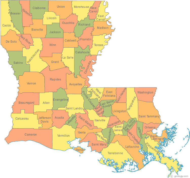
Louisiana Map
N avigate Louisiana Map, Louisiana states map, satellite images of the Louisiana, Louisiana largest cities maps, political map of Louisiana, driving directions and traffic maps.
All Louisiana Cities Maps by Population
- New Orleans Map - (343,829)
- Baton Rouge Map - (229,493)
- Shreveport Map - (199,311)
- Metairie Map - (138,481)
- Lafayette Map - (120,623)
- Lake Charles Map - (71,993)
- Kenner Map - (66,702)
- Bossier City Map - (61,315)
- Monroe Map - (48,815)
- Alexandria Map - (47,723)
- Houma Map - (33,727)
- Marrero Map - (33,141)
- New Iberia Map - (30,617)
- Laplace Map - (29,872)
- Slidell Map - (27,068)
- Prairieville Map - (26,895)
- Central Map - (26,864)
- Terrytown Map - (23,319)
- Ruston Map - (21,859)
- Sulphur Map - (20,410)
- Harvey Map - (20,348)
- Hammond Map - (20,019)
- Bayou Cane Map - (19,355)
- Shenandoah Map - (18,399)
- Natchitoches Map - (18,323)
- Gretna Map - (17,736)
- Chalmette Map - (16,751)
- Opelousas Map - (16,634)
- Estelle Map - (16,377)
- Zachary Map - (14,960)
- Thibodaux Map - (14,566)
- Pineville Map - (14,555)
- Baker Map - (13,895)
- River Ridge Map - (13,494)
- Crowley Map - (13,265)
- Minden Map - (13,082)
- West Monroe Map - (13,065)
- Belle Chasse Map - (12,679)
- Morgan City Map - (12,404)
- Bayou Blue Map - (12,352)
- Abbeville Map - (12,257)
- Bogalusa Map - (12,232)
- Luling Map - (12,119)
- Woodmere Map - (12,080)
- Mandeville Map - (11,560)
- Moss Bluff Map - (11,557)
- Destrehan Map - (11,535)
- Claiborne Map - (11,507)
- Bastrop Map - (11,365)
- Jefferson Map - (11,193)
- Gardere Map - (10,580)
- DeRidder Map - (10,578)
- Eunice Map - (10,398)
- Jennings Map - (10,383)
- Timberlane Map - (10,243)
- Denham Springs Map - (10,215)
- Raceland Map - (10,193)
- Waggaman Map - (10,015)
- Gonzales Map - (9,781)
- Merrydale Map - (9,772)
- Reserve Map - (9,766)
- Harahan Map - (9,277)
- Fort Polk South Map - (9,038)
- Covington Map - (8,765)
- Lacombe Map - (8,679)
- Scott Map - (8,614)
- Westwego Map - (8,534)
- Broussard Map - (8,197)
- Oak Hills Place Map - (8,195)
- Breaux Bridge Map - (8,139)
- St. Rose Map - (8,122)
- Youngsville Map - (8,105)
- Rayne Map - (7,953)
- Prien Map - (7,810)
- Oakdale Map - (7,780)
- Bridge City Map - (7,706)
- Galliano Map - (7,676)
- Franklin Map - (7,660)
- Carencro Map - (7,526)
- Donaldsonville Map - (7,436)
- Ville Platte Map - (7,430)
- Larose Map - (7,400)
- Tallulah Map - (7,335)
- Plaquemine Map - (7,119)
- Village St. George Map - (7,104)
- Eden Isle Map - (7,041)
- Old Jefferson Map - (6,980)
- Schriever Map - (6,853)
- St. Gabriel Map - (6,677)
- Leesville Map - (6,612)
- Ponchatoula Map - (6,559)
- Red Chute Map - (6,261)
- Inniswold Map - (6,180)
- Walker Map - (6,138)
- St. Martinville Map - (6,114)
- Patterson Map - (6,112)
- Cut Off Map - (5,976)
- Meraux Map - (5,816)
- Marksville Map - (5,702)
- Gray Map - (5,584)
- Jeanerette Map - (5,530)
- Brownfields Map - (5,401)
- Springhill Map - (5,269)
- Port Allen Map - (5,180)
- Chackbay Map - (5,177)
- Monticello Map - (5,172)
- Mansfield Map - (5,001)
- Violet Map - (4,973)
- Avondale Map - (4,954)
- Grambling Map - (4,949)
- Berwick Map - (4,946)
- Winnsboro Map - (4,910)
- Winnfield Map - (4,840)
- New Roads Map - (4,831)
- Jonesboro Map - (4,704)
- Carlyss Map - (4,670)
- Bayou Vista Map - (4,652)
- Elmwood Map - (4,635)
- Kaplan Map - (4,600)
- Westlake Map - (4,568)
- Church Point Map - (4,560)
- Swartz Map - (4,536)
- Brownsville Map - (4,317)
- Vidalia Map - (4,299)
- Bunkie Map - (4,171)
- Amite City Map - (4,141)
- Eastwood Map - (4,093)
- Ball Map - (4,000)
- Lake Providence Map - (3,991)
- Farmerville Map - (3,860)
- Franklinton Map - (3,857)
- Jackson Map - (3,842)
- Rayville Map - (3,695)
- Vivian Map - (3,671)
- South Vacherie Map - (3,642)
- Arabi Map - (3,635)
- Gramercy Map - (3,613)
- Addis Map - (3,593)
- Bawcomville Map - (3,588)
- Lutcher Map - (3,559)
- Ferriday Map - (3,511)
- Haughton Map - (3,454)
- Jena Map - (3,398)
- Richwood Map - (3,392)
- Hahnville Map - (3,344)
- Mamou Map - (3,242)
- Homer Map - (3,237)
- DeQuincy Map - (3,235)
- Welsh Map - (3,226)
- Greenwood Map - (3,219)
- Vinton Map - (3,212)
- Pierre Part Map - (3,169)
- Boutte Map - (3,075)
- Norco Map - (3,074)
- Milton Map - (3,030)
- Westminster Map - (3,008)
- Iowa Map - (2,996)
- Natalbany Map - (2,984)
- Delhi Map - (2,919)
- Arcadia Map - (2,919)
- Chauvin Map - (2,912)
- Blanchard Map - (2,899)
- Sunset Map - (2,897)
- Fort Polk North Map - (2,864)
- Many Map - (2,853)
- Garyville Map - (2,811)
- Lake Arthur Map - (2,738)
- Brusly Map - (2,589)
- Bourg Map - (2,579)
- Lockport Map - (2,578)
- Pearl River Map - (2,506)
- Des Allemands Map - (2,505)
- New Llano Map - (2,504)
- Kinder Map - (2,477)
- Grand Point Map - (2,473)
- Amelia Map - (2,459)
- Edgard Map - (2,441)
- Baldwin Map - (2,436)
- Abita Springs Map - (2,365)
- Poydras Map - (2,351)
- North Vacherie Map - (2,346)
- Haynesville Map - (2,327)
- Minorca Map - (2,317)
- Jonesville Map - (2,265)
- Mathews Map - (2,209)
- Kentwood Map - (2,198)
- Erwinville Map - (2,192)
- Simmesport Map - (2,161)
- Ossun Map - (2,144)
- Erath Map - (2,114)
- Golden Meadow Map - (2,101)
- Bayou Gauche Map - (2,071)
- Port Barre Map - (2,055)
- Cottonport Map - (2,006)
- Lafourche Crossing Map - (2,002)
- Cecilia Map - (1,980)
- Bayou L'Ourse Map - (1,978)
- Coushatta Map - (1,964)
- Benton Map - (1,948)
- Lakeshore Map - (1,930)
- Montz Map - (1,918)
- Jean Lafitte Map - (1,903)
- Charenton Map - (1,903)
- Belle Rose Map - (1,902)
- White Castle Map - (1,883)
- Delcambre Map - (1,866)
- Labadieville Map - (1,854)
- Basile Map - (1,821)
- Stonewall Map - (1,814)
- Presquille Map - (1,807)
- Oberlin Map - (1,770)
- Livingston Map - (1,769)
- St. Francisville Map - (1,765)
- Deville Map - (1,764)
- Port Sulphur Map - (1,760)
- Zwolle Map - (1,759)
- Oak Grove Map - (1,727)
- Cade Map - (1,723)
- Duson Map - (1,716)
- Rosepine Map - (1,692)
- Bernice Map - (1,689)
- Henderson Map - (1,674)
- Independence Map - (1,665)
- Clinton Map - (1,653)
- Pine Prairie Map - (1,610)
- Sterlington Map - (1,594)
- Colfax Map - (1,558)
- Logansport Map - (1,555)
- Montegut Map - (1,540)
- Iota Map - (1,500)
- Ringgold Map - (1,495)
- New Sarpy Map - (1,464)
- Dulac Map - (1,463)
- Varnado Map - (1,461)
- Livonia Map - (1,442)
- Mansura Map - (1,419)
- Sorrento Map - (1,401)
- Gueydan Map - (1,398)
- Bayou Country Club Map - (1,396)
- Olla Map - (1,385)
- Glenmora Map - (1,342)
- Ama Map - (1,316)
- Urania Map - (1,313)
- Paradis Map - (1,298)
- Grand Isle Map - (1,296)
- Midway Map - (1,291)
- Lockport Heights Map - (1,286)
- Hackberry Map - (1,261)
- Vienna Bend Map - (1,251)
- Lecompte Map - (1,227)
- Sibley Map - (1,218)
- Killian Map - (1,206)
- Krotz Springs Map - (1,198)
- Lawtell Map - (1,198)
- Banks Springs Map - (1,192)
- Newellton Map - (1,187)
- Paulina Map - (1,178)
- St. Joseph Map - (1,176)
- Cullen Map - (1,163)
- Elton Map - (1,128)
- Roseland Map - (1,123)
- French Settlement Map - (1,116)
- Barataria Map - (1,109)
- Merryville Map - (1,103)
- Maringouin Map - (1,098)
- Woodworth Map - (1,096)
- Catahoula Map - (1,094)
- Albany Map - (1,088)
- Leonville Map - (1,084)
- Arnaudville Map - (1,057)
- Campti Map - (1,056)
- Supreme Map - (1,052)
- Watson Map - (1,047)
- Melville Map - (1,041)
- Clarks Map - (1,017)
- Plain Dealing Map - (1,015)
- Cotton Valley Map - (1,009)
- Oil City Map - (1,008)
- Boyce Map - (1,004)
- Slaughter Map - (997)
- Empire Map - (993)
- Gibsland Map - (979)
- Lafitte Map - (972)
- Wisner Map - (964)
- Maurice Map - (964)
- Washington Map - (964)
- Dubach Map - (961)
- Crescent Map - (959)
- Lydia Map - (952)
- Lakeview Map - (948)
- Grand Coteau Map - (947)
- Buras Map - (945)
- Kraemer Map - (934)
- Moreauville Map - (929)
- Fordoche Map - (928)
- Paincourtville Map - (911)
- Start Map - (905)
- Union Map - (892)
- Sarepta Map - (891)
- Ventress Map - (890)
- Estherwood Map - (889)
- Loreauville Map - (887)
- Choctaw Map - (879)
- Anacoco Map - (869)
- Lemannville Map - (860)
- Epps Map - (854)
- Boothville Map - (854)
- Choudrant Map - (845)
- Simsboro Map - (841)
- St. James Map - (828)
- Doyline Map - (818)
- Forest Hill Map - (818)
- Morse Map - (812)
- Hessmer Map - (802)
- Fifth Ward Map - (800)
- Welcome Map - (800)
- Rosedale Map - (793)
- Killona Map - (793)
- Mooringsport Map - (793)
- Hayes Map - (780)
- Sorrel Map - (766)
- Marion Map - (765)
- Madisonville Map - (748)
- Tangipahoa Map - (748)
- Port Vincent Map - (741)
- Reddell Map - (733)
- Montgomery Map - (730)
- Pleasant Hill Map - (723)
- Greensburg Map - (718)
- Folsom Map - (716)
- Clayton Map - (711)
- Convent Map - (711)
- Wallace Ridge Map - (710)
- Ridgecrest Map - (694)
- Tickfaw Map - (694)
- Waterproof Map - (688)
- Calhoun Map - (679)
- Mangham Map - (672)
- Wallace Map - (671)
- Starks Map - (664)
- Mermentau Map - (661)
- Napoleonville Map - (660)
- Gillis Map - (657)
- Parks Map - (653)
- Grosse Tete Map - (647)
- Simpson Map - (638)
- Longville Map - (635)
- Florien Map - (633)
- Egan Map - (631)
- Mer Rouge Map - (628)
- Cheneyville Map - (625)
- Bayou Goula Map - (612)
- Provencal Map - (611)
- Morganza Map - (610)
- Natchez Map - (597)
- Wilson Map - (595)
- Martin Map - (594)
- Junction City Map - (582)
- Richmond Map - (577)
- Pitkin Map - (576)
- Chatham Map - (557)
- Roanoke Map - (546)
- Elizabeth Map - (532)
- Grayson Map - (532)
- Sicily Island Map - (526)
- Bordelonville Map - (525)
- Gilbert Map - (521)
- Fort Jesup Map - (509)
- Clarence Map - (499)
- Hester Map - (498)
- Center Point Map - (492)
- Springfield Map - (487)
- Cankton Map - (484)
- Lacassine Map - (480)
- Hornbeck Map - (480)
- Prospect Map - (476)
- Hodge Map - (470)
- Sun Map - (470)
- Pollock Map - (469)
- Spokane Map - (442)
- Turkey Creek Map - (441)
- Converse Map - (440)
- Monterey Map - (439)
- Dry Prong Map - (436)
- Goldonna Map - (430)
- Siracusaville Map - (422)
- Oretta Map - (418)
- Kilbourne Map - (416)
- Cameron Map - (406)
- Point Place Map - (400)
- Columbia Map - (390)
- Branch Map - (388)
- North Hodge Map - (388)
- Vienna Map - (386)
- Tullos Map - (385)
- Joyce Map - (384)
- Fenton Map - (379)
- Chataignier Map - (364)
- Belmont Map - (361)
- Forest Map - (355)
- Harrisonburg Map - (348)
- South Mansfield Map - (346)
- Dodson Map - (337)
- Georgetown Map - (327)
- St. Maurice Map - (323)
- Norwood Map - (322)
- Hosston Map - (318)
- Evergreen Map - (310)
- Hall Summit Map - (300)
- Keachi Map - (295)
- East Hodge Map - (289)
- Singer Map - (287)
- Collinston Map - (287)
- Delta Map - (284)
- Bonita Map - (284)
- Saline Map - (277)
- Rock Hill Map - (274)
- Dixie Inn Map - (273)
- Dubberly Map - (273)
- Lucky Map - (272)
- Rodessa Map - (270)
- Ashland Map - (269)
- Montpelier Map - (266)
- Belcher Map - (263)
- Castor Map - (258)
- Baskin Map - (254)
- Noble Map - (252)
- Angie Map - (251)
- Pleasure Bend Map - (250)
- Athens Map - (249)
- Plaucheville Map - (248)
- Heflin Map - (244)
- Grand Cane Map - (242)
- Calvin Map - (238)
- Reeves Map - (232)
- Fisher Map - (230)
- Ida Map - (221)
- Bienville Map - (218)
- Edgefield Map - (218)
- Triumph Map - (216)
- Creola Map - (213)
- Jordan Hill Map - (211)
- McNary Map - (211)
- Glencoe Map - (211)
- Venice Map - (202)
- Moonshine Map - (194)
- Pointe a la Hache Map - (187)
- Lisbon Map - (185)
- Shongaloo Map - (182)
- Quitman Map - (181)
- Robeline Map - (174)
- Palmetto Map - (164)
- Gilliam Map - (164)
- Atlanta Map - (163)
- Longstreet Map - (157)
- Pioneer Map - (156)
- Eros Map - (155)
- Oak Ridge Map - (144)
- Frierson Map - (143)
- Downsville Map - (141)
- Jamestown Map - (139)
- Spearsville Map - (137)
- Powhatan Map - (135)
- Romeville Map - (130)
- Sikes Map - (119)
- Lillie Map - (118)
- Bryceland Map - (108)
- Stanley Map - (107)
- Gloster Map - (94)
- Mount Lebanon Map - (83)
- Taft Map - (63)
- Sugartown Map - (54)
- Mound Map - (19)
Largest Louisiana cities map
Louisiana Google Map, Street Views, Maps Directions, Satellite Images
Please Not : You can find local businesses, public places, tourist attractions via map view, satellite image, hybrid view, driving directions in Louisiana Map. You'll also find a varity map of Louisiana such as political, administrative, transportation, demographics maps following Google map.
Submit URL to Louisiana :
Click for Louisiana Direction »
Click for Louisiana Street View »
Largest Cities Map of Louisiana and Population
New Orleans Map - 343,829 Baton Rouge Map - 229,493 Shreveport Map - 199,311 Metairie Map - 138,481 Lafayette Map - 120,623 Lake Charles Map - 71,993 Kenner Map - 66,702 Bossier City Map - 61,315 Monroe Map - 48,815 Alexandria Map - 47,723 Houma Map - 33,727 Marrero Map - 33,141 New Iberia Map - 30,617 Laplace Map - 29,872 Slidell Map - 27,068Copyright Turkey Travel Guide - 2006 - 2023. All rights reserved. Privacy Policy | Disclaimer