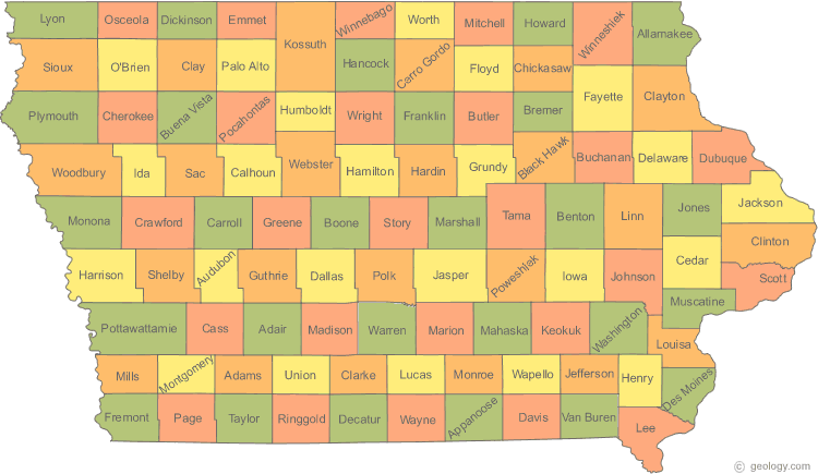
Iowa Map
N avigate Iowa Map, Iowa states map, satellite images of the Iowa, Iowa largest cities maps, political map of Iowa, driving directions and traffic maps.
All Iowa Cities Maps by Population
- Des Moines Map - (203,433)
- Cedar Rapids Map - (126,326)
- Davenport Map - (99,685)
- Sioux City Map - (82,684)
- Waterloo Map - (68,406)
- Iowa City Map - (67,862)
- Council Bluffs Map - (62,230)
- Ames Map - (58,965)
- Dubuque Map - (57,637)
- West Des Moines Map - (56,609)
- Ankeny Map - (45,582)
- Urbandale Map - (39,463)
- Cedar Falls Map - (39,260)
- Marion Map - (34,768)
- Bettendorf Map - (33,217)
- Mason City Map - (28,079)
- Marshalltown Map - (27,552)
- Clinton Map - (26,885)
- Burlington Map - (25,663)
- Fort Dodge Map - (25,206)
- Ottumwa Map - (25,023)
- Muscatine Map - (22,886)
- Coralville Map - (18,907)
- Johnston Map - (17,278)
- Clive Map - (15,447)
- Newton Map - (15,254)
- Indianola Map - (14,782)
- Altoona Map - (14,541)
- Waukee Map - (13,790)
- North Liberty Map - (13,374)
- Boone Map - (12,661)
- Oskaloosa Map - (11,463)
- Spencer Map - (11,233)
- Fort Madison Map - (11,051)
- Keokuk Map - (10,780)
- Storm Lake Map - (10,600)
- Pella Map - (10,352)
- Carroll Map - (10,103)
- Waverly Map - (9,874)
- Le Mars Map - (9,826)
- Fairfield Map - (9,464)
- Grinnell Map - (9,218)
- Norwalk Map - (8,945)
- Pleasant Hill Map - (8,785)
- Mount Pleasant Map - (8,668)
- Denison Map - (8,298)
- Grimes Map - (8,246)
- Decorah Map - (8,127)
- Webster City Map - (8,070)
- Creston Map - (7,834)
- Clear Lake Map - (7,777)
- Perry Map - (7,702)
- Charles City Map - (7,652)
- Knoxville Map - (7,313)
- Washington Map - (7,266)
- Atlantic Map - (7,112)
- Sioux Center Map - (7,048)
- Hiawatha Map - (7,024)
- Nevada Map - (6,798)
- Oelwein Map - (6,415)
- Estherville Map - (6,360)
- Maquoketa Map - (6,141)
- Orange City Map - (6,004)
- Independence Map - (5,966)
- Red Oak Map - (5,742)
- Eldridge Map - (5,651)
- Clarinda Map - (5,572)
- Algona Map - (5,560)
- Anamosa Map - (5,533)
- Centerville Map - (5,528)
- De Witt Map - (5,322)
- Glenwood Map - (5,269)
- Vinton Map - (5,257)
- Cherokee Map - (5,253)
- Iowa Falls Map - (5,238)
- Winterset Map - (5,190)
- Sheldon Map - (5,188)
- Manchester Map - (5,179)
- Shenandoah Map - (5,150)
- Harlan Map - (5,106)
- Osceola Map - (4,929)
- Windsor Heights Map - (4,860)
- Spirit Lake Map - (4,840)
- Evansdale Map - (4,751)
- Humboldt Map - (4,690)
- Mount Vernon Map - (4,506)
- Hampton Map - (4,461)
- Camanche Map - (4,448)
- Jefferson Map - (4,345)
- Chariton Map - (4,321)
- Sergeant Bluff Map - (4,227)
- Asbury Map - (4,170)
- Forest City Map - (4,151)
- Dyersville Map - (4,058)
- Emmetsburg Map - (3,904)
- Waukon Map - (3,897)
- Carlisle Map - (3,876)
- Cresco Map - (3,868)
- Bondurant Map - (3,860)
- Monticello Map - (3,796)
- Carter Lake Map - (3,785)
- Albia Map - (3,766)
- Le Claire Map - (3,765)
- West Liberty Map - (3,736)
- Adel Map - (3,682)
- Osage Map - (3,619)
- Eagle Grove Map - (3,583)
- New Hampton Map - (3,571)
- Story City Map - (3,431)
- Polk City Map - (3,418)
- Rock Valley Map - (3,354)
- Huxley Map - (3,317)
- Saylorville Map - (3,301)
- Tipton Map - (3,221)
- Robins Map - (3,142)
- Garner Map - (3,129)
- Williamsburg Map - (3,068)
- Onawa Map - (2,998)
- West Burlington Map - (2,968)
- Milford Map - (2,898)
- Tama Map - (2,877)
- Clarion Map - (2,850)
- Missouri Valley Map - (2,838)
- Wilton Map - (2,802)
- Sibley Map - (2,798)
- Eldora Map - (2,732)
- Grundy Center Map - (2,706)
- Bloomfield Map - (2,640)
- Rock Rapids Map - (2,549)
- Hawarden Map - (2,546)
- Madrid Map - (2,543)
- Belle Plaine Map - (2,534)
- Marengo Map - (2,528)
- Jesup Map - (2,520)
- West Union Map - (2,486)
- Center Point Map - (2,421)
- Park View Map - (2,389)
- Belmond Map - (2,376)
- Kalona Map - (2,363)
- Toledo Map - (2,341)
- Lamoni Map - (2,324)
- West Branch Map - (2,322)
- La Porte City Map - (2,285)
- Hudson Map - (2,282)
- Mitchellville Map - (2,254)
- Postville Map - (2,227)
- Sac City Map - (2,220)
- Bellevue Map - (2,191)
- Audubon Map - (2,176)
- Hull Map - (2,175)
- Cascade Map - (2,159)
- Lisbon Map - (2,152)
- Ida Grove Map - (2,142)
- Fairfax Map - (2,123)
- Lake Mills Map - (2,100)
- Colfax Map - (2,093)
- Britt Map - (2,069)
- Wapello Map - (2,067)
- Sigourney Map - (2,059)
- Ogden Map - (2,044)
- Solon Map - (2,037)
- Sumner Map - (2,028)
- Northwood Map - (1,989)
- Greenfield Map - (1,982)
- Leon Map - (1,977)
- Tiffin Map - (1,947)
- Guttenberg Map - (1,919)
- Columbus Junction Map - (1,899)
- New London Map - (1,897)
- Alta Map - (1,883)
- Parkersburg Map - (1,870)
- Epworth Map - (1,860)
- Durant Map - (1,832)
- Monroe Map - (1,830)
- Pocahontas Map - (1,789)
- Denver Map - (1,780)
- Ely Map - (1,776)
- Lake City Map - (1,727)
- Rockwell City Map - (1,709)
- Traer Map - (1,703)
- Pleasantville Map - (1,694)
- Mount Ayr Map - (1,691)
- Manson Map - (1,690)
- Prairie City Map - (1,680)
- Hartley Map - (1,672)
- Atkins Map - (1,670)
- Reinbeck Map - (1,664)
- Remsen Map - (1,663)
- Nashua Map - (1,663)
- Stuart Map - (1,648)
- Corning Map - (1,635)
- Walcott Map - (1,629)
- Dallas Center Map - (1,623)
- Moville Map - (1,618)
- Ackley Map - (1,589)
- Corydon Map - (1,585)
- Guthrie Center Map - (1,569)
- Mediapolis Map - (1,560)
- Monona Map - (1,549)
- Farley Map - (1,537)
- Logan Map - (1,534)
- Oakland Map - (1,527)
- Avoca Map - (1,506)
- Manning Map - (1,500)
- Slater Map - (1,489)
- Akron Map - (1,486)
- State Center Map - (1,468)
- Brooklyn Map - (1,468)
- Walford Map - (1,463)
- Montezuma Map - (1,462)
- Woodbine Map - (1,459)
- Urbana Map - (1,458)
- Blue Grass Map - (1,452)
- Earlham Map - (1,450)
- Bedford Map - (1,440)
- Clarksville Map - (1,439)
- Nora Springs Map - (1,431)
- Kingsley Map - (1,411)
- Wellman Map - (1,408)
- Lenox Map - (1,407)
- Sanborn Map - (1,404)
- Holstein Map - (1,396)
- Dysart Map - (1,379)
- Peosta Map - (1,377)
- Fayette Map - (1,338)
- Manly Map - (1,323)
- Tripoli Map - (1,313)
- Lake Panorama Map - (1,309)
- Coon Rapids Map - (1,305)
- Lone Tree Map - (1,300)
- Shell Rock Map - (1,296)
- New Sharon Map - (1,293)
- Melcher Dallas Map - (1,288)
- Roland Map - (1,284)
- Strawberry Point Map - (1,279)
- Elkader Map - (1,273)
- Buffalo Map - (1,270)
- Laurens Map - (1,258)
- Central City Map - (1,257)
- Villisca Map - (1,252)
- Granger Map - (1,244)
- Mapleton Map - (1,224)
- Alton Map - (1,216)
- Jewell Junction Map - (1,215)
- Dike Map - (1,209)
- Hamburg Map - (1,187)
- Sheffield Map - (1,172)
- Glidden Map - (1,146)
- Mechanicsville Map - (1,146)
- Lake View Map - (1,142)
- Malvern Map - (1,142)
- Sidney Map - (1,138)
- Winfield Map - (1,134)
- Greene Map - (1,130)
- Aplington Map - (1,128)
- Arnolds Park Map - (1,126)
- Panora Map - (1,124)
- Elk Run Heights Map - (1,117)
- Marcus Map - (1,117)
- Fairbank Map - (1,113)
- Conrad Map - (1,108)
- St. Ansgar Map - (1,107)
- Lake Park Map - (1,105)
- Baxter Map - (1,101)
- Gilbert Map - (1,082)
- George Map - (1,080)
- Springville Map - (1,074)
- Paullina Map - (1,056)
- University Heights Map - (1,051)
- De Soto Map - (1,050)
- Dunlap Map - (1,042)
- North English Map - (1,041)
- Tabor Map - (1,040)
- Rockwell Map - (1,039)
- Gowrie Map - (1,037)
- Aurelia Map - (1,036)
- Griswold Map - (1,036)
- Allison Map - (1,029)
- Palo Map - (1,026)
- Woodward Map - (1,024)
- Eddyville Map - (1,024)
- Van Meter Map - (1,016)
- Odebolt Map - (1,013)
- Preston Map - (1,012)
- Keota Map - (1,009)
- Keosauqua Map - (1,006)
- Lansing Map - (999)
- Riverside Map - (993)
- Shellsburg Map - (983)
- Calmar Map - (978)
- Fruitland Map - (977)
- Clarence Map - (974)
- Sloan Map - (973)
- Anita Map - (972)
- Wayland Map - (966)
- West Point Map - (966)
- Beaverdale Map - (952)
- Gladbrook Map - (945)
- Le Grand Map - (938)
- Danville Map - (934)
- Fredericksburg Map - (931)
- Janesville Map - (930)
- Hinton Map - (928)
- Eldon Map - (927)
- Armstrong Map - (926)
- Maxwell Map - (920)
- Treynor Map - (919)
- Underwood Map - (917)
- Donnellson Map - (912)
- Primghar Map - (909)
- Lawton Map - (908)
- Buffalo Center Map - (905)
- Montrose Map - (898)
- Victor Map - (893)
- Princeton Map - (886)
- Schleswig Map - (882)
- Swisher Map - (879)
- Washburn Map - (876)
- Colo Map - (876)
- Newell Map - (876)
- Newhall Map - (875)
- McGregor Map - (871)
- Larchwood Map - (866)
- Edgewood Map - (864)
- Rockford Map - (860)
- Dunkerton Map - (852)
- Winthrop Map - (850)
- Ossian Map - (845)
- Afton Map - (845)
- Hubbard Map - (845)
- Graettinger Map - (844)
- Dakota City Map - (843)
- Neola Map - (842)
- Exira Map - (840)
- Dayton Map - (837)
- Morning Sun Map - (836)
- Redfield Map - (835)
- Melbourne Map - (830)
- Cambridge Map - (827)
- Grand Junction Map - (824)
- Hazleton Map - (823)
- Correctionville Map - (821)
- Sully Map - (821)
- Wall Lake Map - (819)
- Inwood Map - (814)
- Earlville Map - (812)
- Carson Map - (812)
- Readlyn Map - (808)
- Long Grove Map - (808)
- Oxford Map - (807)
- Okoboji Map - (807)
- Essex Map - (798)
- Walker Map - (791)
- Lowden Map - (789)
- Raymond Map - (788)
- Alden Map - (787)
- Riceville Map - (785)
- Walnut Map - (785)
- West Bend Map - (785)
- Adair Map - (781)
- Manilla Map - (776)
- Milo Map - (775)
- Sioux Rapids Map - (775)
- Schaller Map - (772)
- Hartford Map - (771)
- Hedrick Map - (764)
- Wheatland Map - (764)
- Whiting Map - (762)
- Murray Map - (756)
- Merrill Map - (755)
- Garnavillo Map - (745)
- Stratford Map - (743)
- Fremont Map - (743)
- Ruthven Map - (737)
- Bancroft Map - (732)
- Ventura Map - (717)
- Battle Creek Map - (713)
- Gilbertville Map - (712)
- Wellsburg Map - (707)
- Boyden Map - (707)
- Hills Map - (703)
- Seymour Map - (701)
- Albert City Map - (699)
- Hospers Map - (698)
- Olin Map - (698)
- Blairstown Map - (692)
- Stanton Map - (689)
- Stanwood Map - (684)
- Elgin Map - (683)
- Elkhart Map - (683)
- Van Horne Map - (682)
- Alburnett Map - (673)
- Fontanelle Map - (672)
- Moravia Map - (665)
- Farmington Map - (664)
- Elk Horn Map - (662)
- Pomeroy Map - (662)
- Coggon Map - (658)
- St. Charles Map - (653)
- Kanawha Map - (652)
- Brighton Map - (652)
- Sutherland Map - (649)
- What Cheer Map - (646)
- Grand Mound Map - (642)
- Shelby Map - (641)
- Agency Map - (638)
- Dumont Map - (637)
- Goldfield Map - (635)
- Clermont Map - (632)
- Fonda Map - (631)
- Hopkinton Map - (628)
- Keystone Map - (622)
- Crescent Map - (617)
- Dexter Map - (611)
- Coalville Map - (610)
- Ireton Map - (609)
- Orleans Map - (608)
- Moulton Map - (605)
- Everly Map - (603)
- Kellogg Map - (599)
- Minden Map - (599)
- Lakeside Map - (596)
- Rolfe Map - (584)
- Richland Map - (584)
- Middle Amana Map - (581)
- Doon Map - (577)
- Shueyville Map - (577)
- Sabula Map - (576)
- Ainsworth Map - (567)
- Anthon Map - (565)
- Badger Map - (561)
- Early Map - (557)
- Scranton Map - (557)
- Grandview Map - (556)
- Zearing Map - (554)
- Quasqueton Map - (554)
- Russell Map - (554)
- Elma Map - (546)
- Radcliffe Map - (545)
- Norway Map - (545)
- Otho Map - (542)
- Lovilia Map - (538)
- Dows Map - (538)
- Swea City Map - (536)
- Burt Map - (533)
- Ellsworth Map - (531)
- Garwin Map - (527)
- Delmar Map - (525)
- New Albin Map - (522)
- Maynard Map - (518)
- New Hartford Map - (516)
- Wyoming Map - (515)
- Dow City Map - (510)
- Gilman Map - (509)
- Runnells Map - (507)
- Latimer Map - (507)
- Klemme Map - (507)
- Lime Springs Map - (505)
- Albion Map - (505)
- Whittemore Map - (504)
- Gilmore City Map - (504)
- Thompson Map - (502)
- Charter Oak Map - (502)
- Allerton Map - (501)
- Batavia Map - (499)
- Oxford Junction Map - (496)
- Collins Map - (495)
- Stacyville Map - (494)
- Humeston Map - (494)
- Beacon Map - (494)
- Ocheyedan Map - (490)
- New Virginia Map - (489)
- University Park Map - (487)
- Farragut Map - (485)
- Truro Map - (485)
- Arcadia Map - (484)
- Breda Map - (483)
- Titonka Map - (476)
- Pacific Junction Map - (471)
- Bayard Map - (471)
- Martensdale Map - (465)
- Lamont Map - (461)
- Delhi Map - (460)
- Little Rock Map - (459)
- Ashton Map - (458)
- Hawkeye Map - (449)
- Birmingham Map - (448)
- Royal Map - (446)
- Lost Nation Map - (446)
- Miles Map - (445)
- Milton Map - (443)
- Amana Map - (442)
- Calamus Map - (439)
- Lawler Map - (439)
- Emerson Map - (438)
- Earling Map - (437)
- Vail Map - (436)
- Plainfield Map - (436)
- Andrew Map - (434)
- Galva Map - (434)
- Holiday Lake Map - (433)
- Bonaparte Map - (433)
- Lewis Map - (433)
- Alleman Map - (432)
- Conesville Map - (432)
- Arlington Map - (429)
- Casey Map - (426)
- Mystic Map - (425)
- Denmark Map - (423)
- Ringsted Map - (422)
- Thornton Map - (422)
- Bussey Map - (422)
- Stanhope Map - (422)
- Lehigh Map - (416)
- New Market Map - (415)
- Duncombe Map - (410)
- Orient Map - (408)
- New Vienna Map - (407)
- Bennett Map - (405)
- Riverdale Map - (405)
- Colesburg Map - (404)
- Mondamin Map - (402)
- Worthington Map - (401)
- Union Map - (397)
- Charlotte Map - (394)
- Columbus City Map - (391)
- Wesley Map - (390)
- Churdan Map - (386)
- Letts Map - (384)
- Livermore Map - (384)
- Salem Map - (383)
- Plymouth Map - (382)
- Lynnville Map - (379)
- Callender Map - (376)
- Marquette Map - (375)
- Holy Cross Map - (374)
- Nichols Map - (374)
- Ute Map - (374)
- Garrison Map - (371)
- Farnhamville Map - (371)
- Fertile Map - (370)
- Rudd Map - (369)
- Lohrville Map - (368)
- Spillville Map - (367)
- Terril Map - (367)
- Pierson Map - (366)
- Diamondhead Lake Map - (366)
- Minburn Map - (365)
- Salix Map - (363)
- Clearfield Map - (363)
- Templeton Map - (362)
- Lacona Map - (361)
- Ryan Map - (361)
- Lorimor Map - (360)
- Cincinnati Map - (357)
- Massena Map - (355)
- Menlo Map - (353)
- Cumming Map - (351)
- Elliott Map - (350)
- Fort Atkinson Map - (349)
- Danbury Map - (348)
- Donahue Map - (346)
- Williams Map - (344)
- Wahpeton Map - (341)
- Irwin Map - (341)
- Floyd Map - (335)
- Peterson Map - (334)
- Twin Lakes Map - (334)
- McCallsburg Map - (333)
- Diagonal Map - (330)
- Harpers Ferry Map - (328)
- Delta Map - (328)
- Kimballton Map - (322)
- Auburn Map - (322)
- Bronson Map - (322)
- Quimby Map - (319)
- Sheldahl Map - (319)
- Persia Map - (319)
- Middletown Map - (318)
- Lytton Map - (315)
- Ridgeway Map - (315)
- Libertyville Map - (315)
- Kellerton Map - (315)
- Granville Map - (312)
- Atalissa Map - (311)
- Steamboat Rock Map - (310)
- Corwith Map - (309)
- Brandon Map - (309)
- Kelley Map - (309)
- Marble Rock Map - (307)
- Rhodes Map - (305)
- Riverton Map - (304)
- Harcourt Map - (303)
- Bagley Map - (303)
- Farmersburg Map - (302)
- Mingo Map - (302)
- Bode Map - (302)
- Liscomb Map - (301)
- Westside Map - (299)
- Blakesburg Map - (296)
- Stockport Map - (296)
- Bertram Map - (294)
- Lester Map - (294)
- Rippey Map - (292)
- Ionia Map - (291)
- McCausland Map - (291)
- Leland Map - (289)
- West Okoboji Map - (289)
- Low Moor Map - (288)
- Malcom Map - (287)
- Defiance Map - (284)
- Protivin Map - (283)
- Ladora Map - (283)
- Modale Map - (283)
- Holland Map - (282)
- Coulter Map - (281)
- Kiron Map - (279)
- Deep River Map - (279)
- Fenton Map - (279)
- Maurice Map - (275)
- Mallard Map - (274)
- Luana Map - (269)
- Lockridge Map - (268)
- Chelsea Map - (267)
- Dedham Map - (266)
- Kensett Map - (266)
- Alta Vista Map - (266)
- Crawfordsville Map - (264)
- Rowley Map - (264)
- Deloit Map - (264)
- Cumberland Map - (262)
- Wadena Map - (262)
- Lu Verne Map - (261)
- Pulaski Map - (260)
- La Motte Map - (260)
- Maharishi Vedic City Map - (259)
- Conroy Map - (259)
- Prescott Map - (257)
- Waucoma Map - (257)
- Greeley Map - (256)
- Meservey Map - (256)
- Lakota Map - (255)
- Martelle Map - (255)
- Grafton Map - (252)
- Pisgah Map - (251)
- Crystal Lake Map - (250)
- Montour Map - (249)
- Washta Map - (248)
- Dixon Map - (247)
- Halbur Map - (246)
- Keswick Map - (246)
- Macedonia Map - (246)
- Yale Map - (246)
- Silver City Map - (245)
- Fredonia Map - (244)
- Renwick Map - (242)
- Cleghorn Map - (240)
- Goose Lake Map - (240)
- Luxemburg Map - (240)
- Laurel Map - (239)
- Marathon Map - (237)
- Grand River Map - (236)
- Paton Map - (236)
- Harvey Map - (235)
- Fostoria Map - (231)
- Van Wert Map - (230)
- Woden Map - (229)
- Thurman Map - (229)
- Olds Map - (229)
- New Providence Map - (228)
- Hanlontown Map - (226)
- Moorhead Map - (226)
- Rake Map - (225)
- Hornick Map - (225)
- Stout Map - (224)
- Jamaica Map - (224)
- Smithland Map - (224)
- Blencoe Map - (224)
- Cantril Map - (222)
- Joice Map - (222)
- Panama Map - (221)
- Cushing Map - (220)
- Lineville Map - (217)
- Lucas Map - (216)
- Ollie Map - (215)
- Blairsburg Map - (215)
- College Springs Map - (214)
- Melvin Map - (214)
- Clutier Map - (213)
- South English Map - (212)
- Garden Grove Map - (211)
- Westgate Map - (211)
- Volga Map - (208)
- Arthur Map - (206)
- Packwood Map - (204)
- Davis City Map - (204)
- Rembrandt Map - (203)
- Woodburn Map - (202)
- Kamrar Map - (199)
- Linden Map - (199)
- Onslow Map - (197)
- Wallingford Map - (197)
- Decatur City Map - (197)
- Stockton Map - (197)
- Alvord Map - (196)
- Hancock Map - (196)
- Elberon Map - (196)
- Portsmouth Map - (195)
- Boxholm Map - (195)
- Coin Map - (193)
- Parnell Map - (193)
- Stone City Map - (192)
- Blockton Map - (192)
- Barnum Map - (191)
- Beaman Map - (191)
- Shambaugh Map - (191)
- Gravity Map - (188)
- Thor Map - (186)
- Henderson Map - (185)
- Aurora Map - (185)
- Dickens Map - (185)
- Drakesville Map - (184)
- Tingley Map - (184)
- Frederika Map - (183)
- Magnolia Map - (183)
- Rickardsville Map - (182)
- Bridgewater Map - (182)
- Hillsboro Map - (180)
- Lidderdale Map - (180)
- Prairieburg Map - (178)
- Sherrill Map - (177)
- Maysville Map - (176)
- Barnes City Map - (176)
- Alexander Map - (175)
- Dundee Map - (174)
- Vincent Map - (174)
- Soldier Map - (174)
- Castalia Map - (173)
- Randall Map - (173)
- Oakville Map - (173)
- Haverhill Map - (173)
- Pilot Mound Map - (173)
- Lambs Grove Map - (172)
- Calumet Map - (170)
- Harris Map - (170)
- Little Sioux Map - (170)
- Moorland Map - (169)
- Woolstock Map - (168)
- Randolph Map - (168)
- Rose Hill Map - (168)
- Kirkville Map - (167)
- Burr Oak Map - (166)
- Mineola Map - (166)
- Swaledale Map - (165)
- Geneva Map - (165)
- Welton Map - (165)
- Palmer Map - (165)
- Frytown Map - (165)
- Lincoln Map - (162)
- Leighton Map - (162)
- Sun Valley Lake Map - (161)
- Exline Map - (160)
- Bristow Map - (160)
- Delaware Map - (159)
- Millersburg Map - (159)
- South Amana Map - (159)
- Braddyville Map - (159)
- Meriden Map - (159)
- Rowan Map - (158)
- Oakland Acres Map - (156)
- Rock Falls Map - (155)
- Linn Grove Map - (154)
- Monmouth Map - (153)
- Hastings Map - (152)
- Williamson Map - (152)
- Douds Map - (152)
- Reasnor Map - (152)
- McClelland Map - (151)
- Brunsville Map - (151)
- Mount Auburn Map - (150)
- Whitten Map - (149)
- Homestead Map - (148)
- Clemons Map - (148)
- Searsboro Map - (148)
- Castana Map - (147)
- Lone Rock Map - (146)
- West Chester Map - (146)
- Clare Map - (146)
- Houghton Map - (146)
- Ricketts Map - (145)
- Springbrook Map - (144)
- Waterville Map - (144)
- Ayrshire Map - (143)
- St. Lucas Map - (143)
- Franklin Map - (143)
- Webb Map - (141)
- Goodell Map - (139)
- Mitchell Map - (138)
- Floris Map - (138)
- Havelock Map - (138)
- New Liberty Map - (137)
- West Amana Map - (135)
- St. Donatus Map - (135)
- Centralia Map - (134)
- Rochester Map - (133)
- Westfield Map - (132)
- Larrabee Map - (132)
- Duncan Map - (131)
- Archer Map - (131)
- Dawson Map - (131)
- Ledyard Map - (130)
- Superior Map - (130)
- Hamilton Map - (130)
- Patterson Map - (130)
- Bouton Map - (129)
- Panorama Park Map - (129)
- St. Paul Map - (129)
- Brayton Map - (128)
- Chester Map - (127)
- Masonville Map - (127)
- St. Marys Map - (127)
- Westphalia Map - (127)
- Rutland Map - (126)
- Green Mountain Map - (126)
- Ferguson Map - (126)
- Stanley Map - (125)
- Weldon Map - (125)
- East Peru Map - (125)
- Toronto Map - (124)
- McIntire Map - (122)
- Luther Map - (122)
- Sageville Map - (122)
- Lanesboro Map - (121)
- North Buena Vista Map - (121)
- Marne Map - (120)
- Bentley Map - (118)
- Watkins Map - (118)
- Rome Map - (117)
- North Washington Map - (117)
- Wiota Map - (116)
- Morley Map - (115)
- Leando Map - (115)
- Derby Map - (115)
- High Amana Map - (115)
- Harper Map - (114)
- Nodaway Map - (114)
- Macksburg Map - (113)
- Somers Map - (113)
- Westwood Map - (112)
- Martinsburg Map - (112)
- Melrose Map - (112)
- Bernard Map - (112)
- Promise City Map - (111)
- Center Junction Map - (111)
- Carpenter Map - (109)
- Baldwin Map - (109)
- Oto Map - (108)
- Buckeye Map - (108)
- Arion Map - (108)
- St. Olaf Map - (108)
- Mount Union Map - (107)
- Cromwell Map - (107)
- Oyens Map - (103)
- Andover Map - (103)
- St. Anthony Map - (102)
- Unionville Map - (102)
- Fraser Map - (102)
- Arispe Map - (100)
- Bradford Map - (99)
- Hansell Map - (98)
- Climbing Hill Map - (97)
- Chillicothe Map - (97)
- Luzerne Map - (96)
- Morrison Map - (94)
- Gruver Map - (94)
- Pleasant Plain Map - (93)
- Numa Map - (92)
- Weston Map - (92)
- Grant Map - (92)
- New Haven Map - (91)
- Zwingle Map - (91)
- Sharpsburg Map - (89)
- Garden City Map - (89)
- Rathbun Map - (89)
- Craig Map - (89)
- Garber Map - (88)
- Cylinder Map - (88)
- Webster Map - (88)
- Willey Map - (88)
- Chapin Map - (87)
- Percival Map - (87)
- Matlock Map - (87)
- Bradgate Map - (86)
- Hartwick Map - (86)
- California Junction Map - (85)
- Nemaha Map - (85)
- Yorktown Map - (85)
- Keomah Village Map - (84)
- Ackworth Map - (83)
- Redding Map - (82)
- Spragueville Map - (81)
- Truesdale Map - (81)
- Clio Map - (80)
- Ralston Map - (79)
- Popejoy Map - (79)
- Chatsworth Map - (79)
- Graf Map - (79)
- Struble Map - (78)
- Plover Map - (77)
- Greenville Map - (75)
- Aredale Map - (74)
- Kinross Map - (73)
- Colwell Map - (73)
- Imogene Map - (72)
- Scarville Map - (72)
- Swan Map - (72)
- Orchard Map - (71)
- Varina Map - (71)
- Dana Map - (71)
- Shannon City Map - (71)
- Plano Map - (70)
- Rossie Map - (70)
- Tennant Map - (68)
- Balltown Map - (68)
- Turin Map - (68)
- Randalia Map - (68)
- Thornburg Map - (67)
- Marysville Map - (66)
- Dolliver Map - (66)
- Bassett Map - (66)
- Anderson Map - (65)
- Kirkman Map - (64)
- Guernsey Map - (63)
- Bevington Map - (63)
- Spring Hill Map - (63)
- Gray Map - (63)
- Kent Map - (61)
- St. Joseph Map - (61)
- Gibson Map - (61)
- Miller Map - (60)
- Rodney Map - (60)
- Knierim Map - (60)
- Little Cedar Map - (60)
- Thayer Map - (59)
- Osterdock Map - (59)
- River Sioux Map - (59)
- Dougherty Map - (58)
- Northboro Map - (58)
- Curlew Map - (58)
- Jackson Junction Map - (58)
- Valeria Map - (57)
- East Amana Map - (56)
- Ottosen Map - (55)
- Rinard Map - (52)
- Sandyville Map - (51)
- Hayesville Map - (50)
- Bartlett Map - (50)
- Vining Map - (50)
- Roseville Map - (49)
- Pleasanton Map - (49)
- Gillett Grove Map - (49)
- Beaver Map - (48)
- Toeterville Map - (48)
- Cotter Map - (48)
- Coppock Map - (47)
- Udell Map - (47)
- Hardy Map - (47)
- Rodman Map - (45)
- Millerton Map - (45)
- Buck Grove Map - (43)
- Clayton Map - (43)
- Ellston Map - (43)
- Owasa Map - (43)
- Hayfield Map - (43)
- Coburg Map - (42)
- Conway Map - (41)
- Jolley Map - (41)
- Benton Map - (41)
- Burchinal Map - (40)
- Aspinwall Map - (40)
- St. Benedict Map - (39)
- Irvington Map - (38)
- Blanchard Map - (38)
- Elkport Map - (37)
- Sexton Map - (37)
- Mount Sterling Map - (36)
- Loveland Map - (35)
- Portland Map - (35)
- Mona Map - (34)
- Carbon Map - (34)
- Yetter Map - (34)
- Bolan Map - (33)
- Galt Map - (32)
- Berkley Map - (32)
- Meyer Map - (31)
- Millville Map - (30)
- Jacksonville Map - (30)
- Maloy Map - (29)
- Hutchins Map - (28)
- Otranto Map - (27)
- Corley Map - (26)
- Delphos Map - (25)
- Bankston Map - (25)
- Pioneer Map - (23)
- Hepburn Map - (23)
- Durango Map - (22)
- Athelstan Map - (19)
- Le Roy Map - (15)
- Beaconsfield Map - (15)
Largest Iowa cities map
Iowa Google Map, Street Views, Maps Directions, Satellite Images
Please Not : You can find local businesses, public places, tourist attractions via map view, satellite image, hybrid view, driving directions in Iowa Map. You'll also find a varity map of Iowa such as political, administrative, transportation, demographics maps following Google map.
Submit URL to Iowa :
Click for Iowa Direction »
Click for Iowa Street View »
Largest Cities Map of Iowa and Population
Des Moines Map - 203,433 Cedar Rapids Map - 126,326 Davenport Map - 99,685 Sioux City Map - 82,684 Waterloo Map - 68,406 Iowa City Map - 67,862 Council Bluffs Map - 62,230 Ames Map - 58,965 Dubuque Map - 57,637 West Des Moines Map - 56,609 Ankeny Map - 45,582 Urbandale Map - 39,463 Cedar Falls Map - 39,260 Marion Map - 34,768 Bettendorf Map - 33,217Copyright Turkey Travel Guide - 2006 - 2023. All rights reserved. Privacy Policy | Disclaimer