Oregon Map
N avigate Oregon Map, Oregon states map, satellite images of the Oregon, Oregon largest cities maps, political map of Oregon, driving directions and traffic maps.
Oregon Map & Oregon Satellite Images

Oregon Maps
- Map of Oregon
- Oregon Historical Map
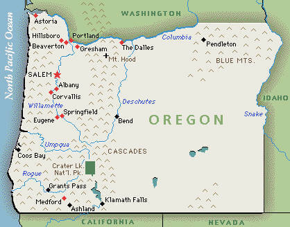
- Oregon Map
- Oregon Map United States
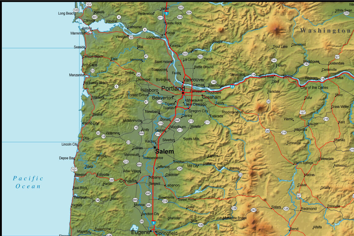
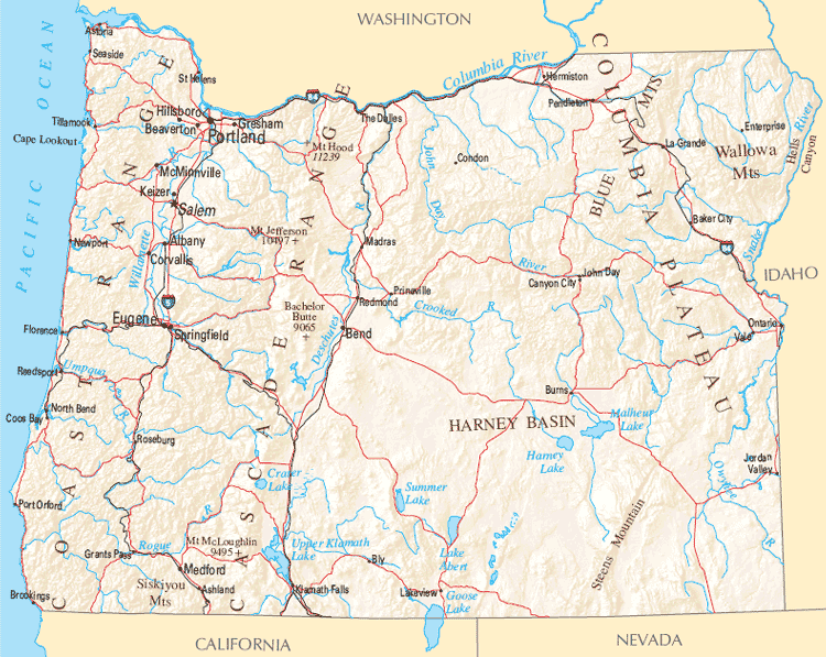
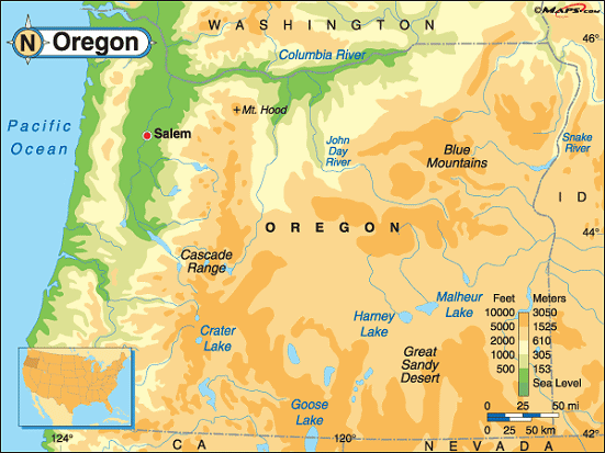
- Oregon Physical Map
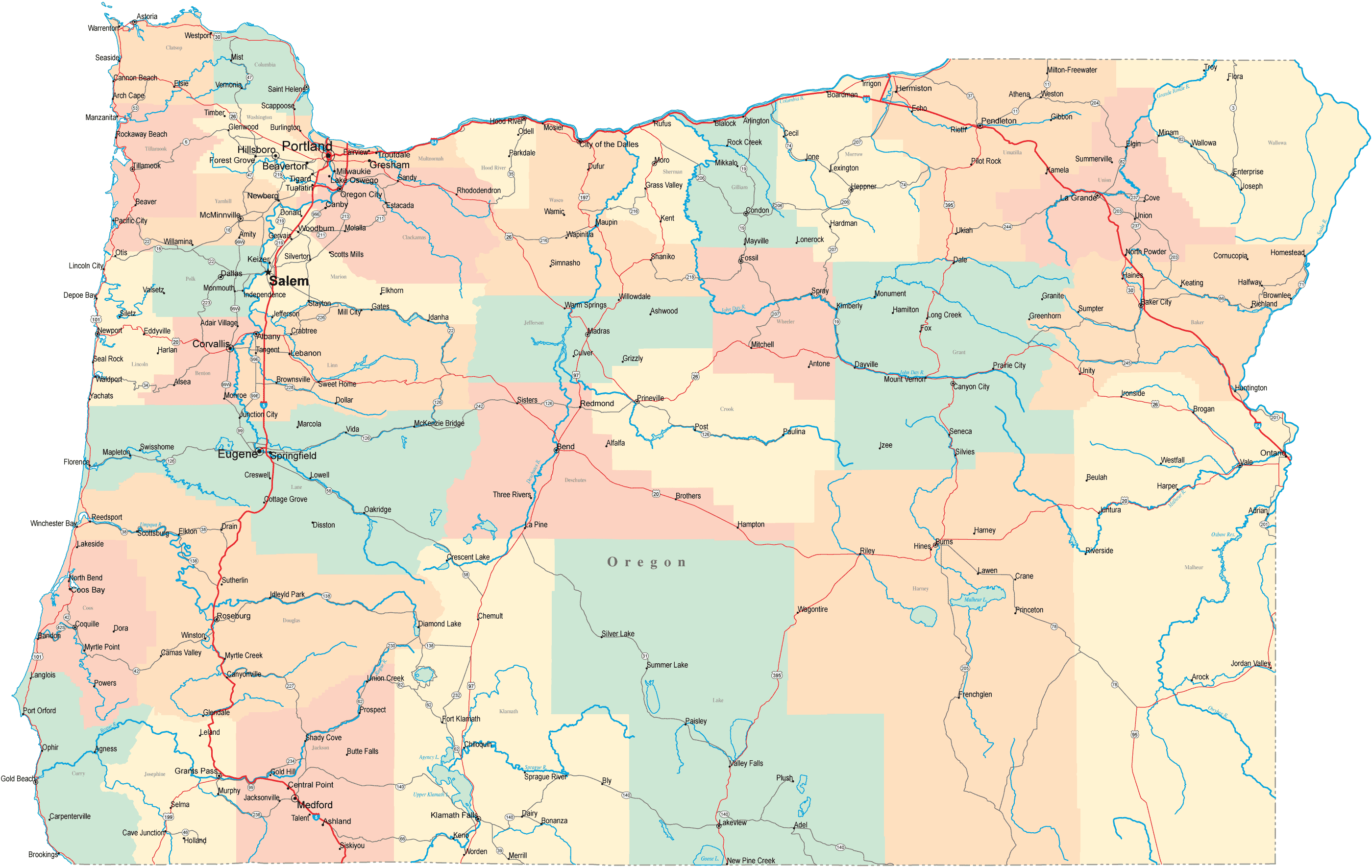
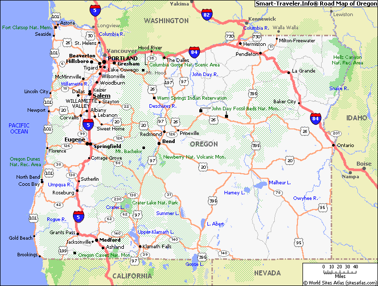
- Oregon Road Map
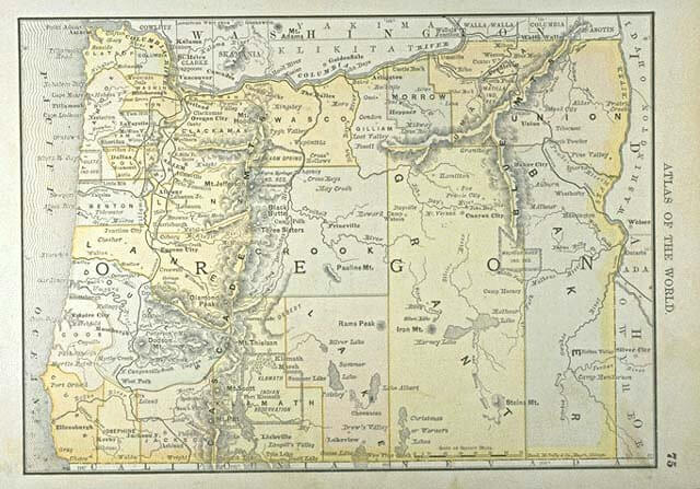
- Oregon Atlas 1886
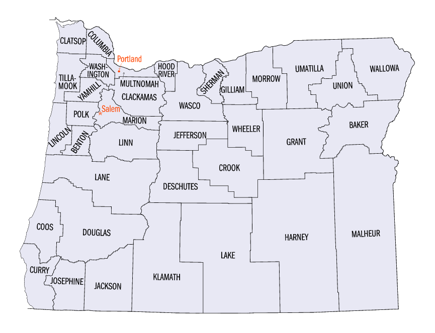
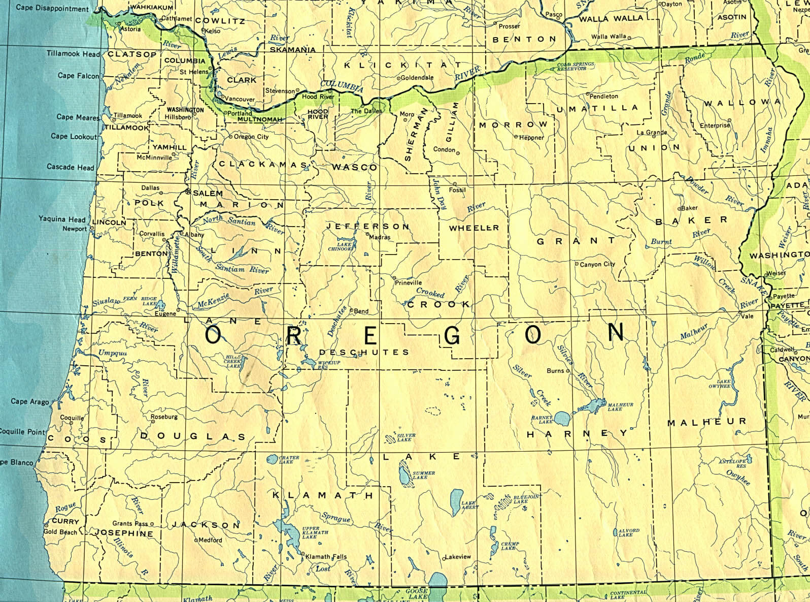
- Oregon Counties Map
- Oregon County Map
- Oregon Geographical Map
- Oregon Historical Map
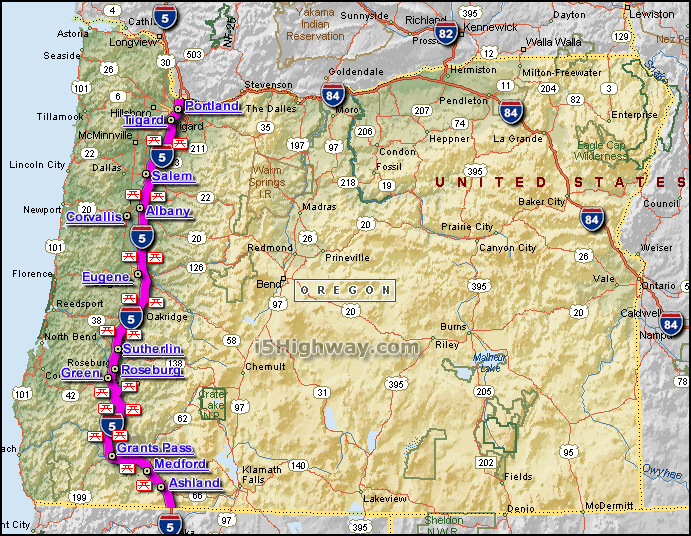
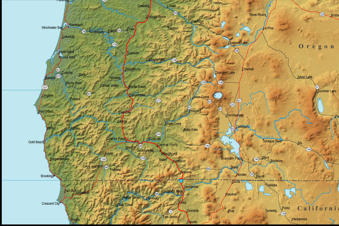
- Oregon Map InterState 5
- Oregon Maps
- Oregon Physical Map USA
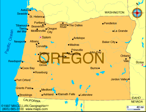
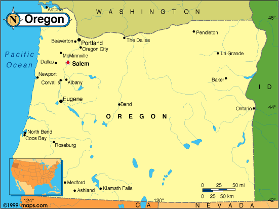
- Oregon Political Map
- Oregon Reference Map
- Oregon Route Map
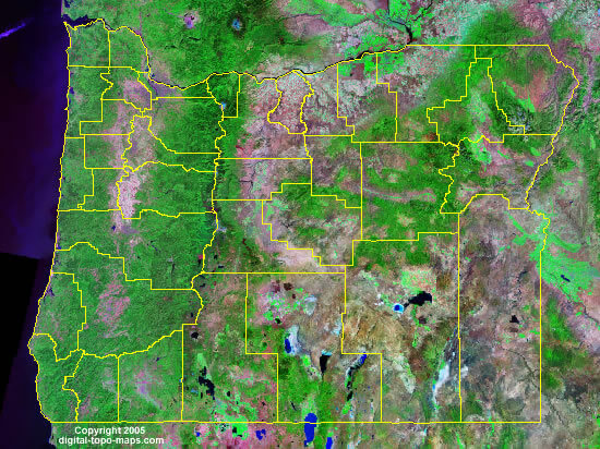
- Oregon Satellite Image
- Oregon State Map
- Oregon State Road Map
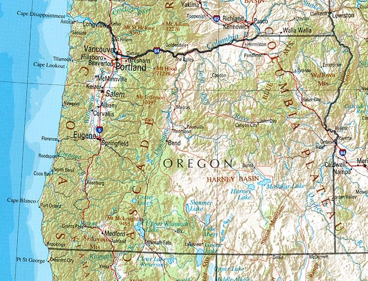
- Physical Map of Oregon
- Political Map of Oregon
- State Map of Oregon
A Collection of Oregon Maps and Oregon Satellite Images


A collection of Oregon Maps

For all Oregon cities map
Click for Oregon Direction »
Click for Oregon Street View »
Largest Cities Map of Oregon and Population
Portland Map - 583,776 Eugene Map - 156,185 Salem Map - 154,637 Gresham Map - 105,594 Hillsboro Map - 91,611 Beaverton Map - 89,803 Bend Map - 76,639 Medford Map - 74,907 Springfield Map - 59,403 Corvallis Map - 54,462 Albany Map - 50,158 Aloha Map - 49,425 Tigard Map - 48,035 Lake Oswego Map - 36,619 Keizer Map - 36,478Copyright Turkey Travel Guide - 2006 - 2023. All rights reserved. Privacy Policy | Disclaimer