Kansas Map
N avigate Kansas Map, Kansas states map, satellite images of the Kansas, Kansas largest cities maps, political map of Kansas, driving directions and traffic maps.
Kansas Map & Kansas Satellite Images

Kansas Maps
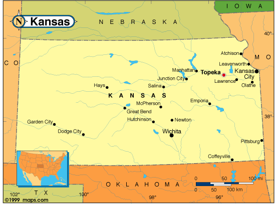
- Map of Kansas
- Kansas Cities Map
- Kansas Cities Map USA
- Kansas Cities Towns Map
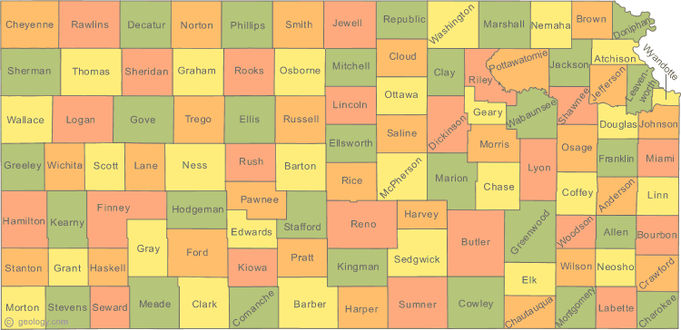
- Kansas County Map
- Kansas Political Map
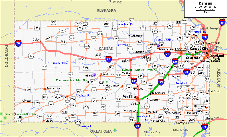
- Kansas Reference Map
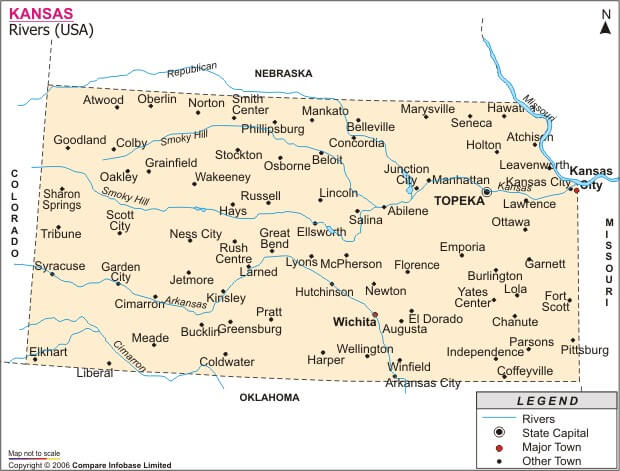
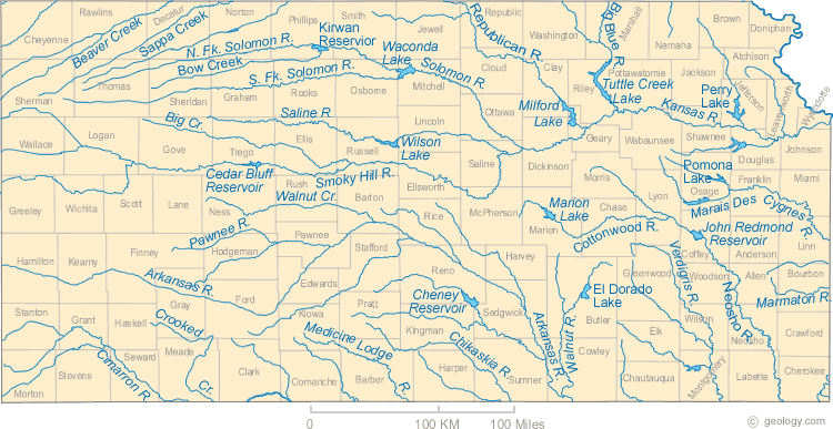
- Kansas Rivers Map
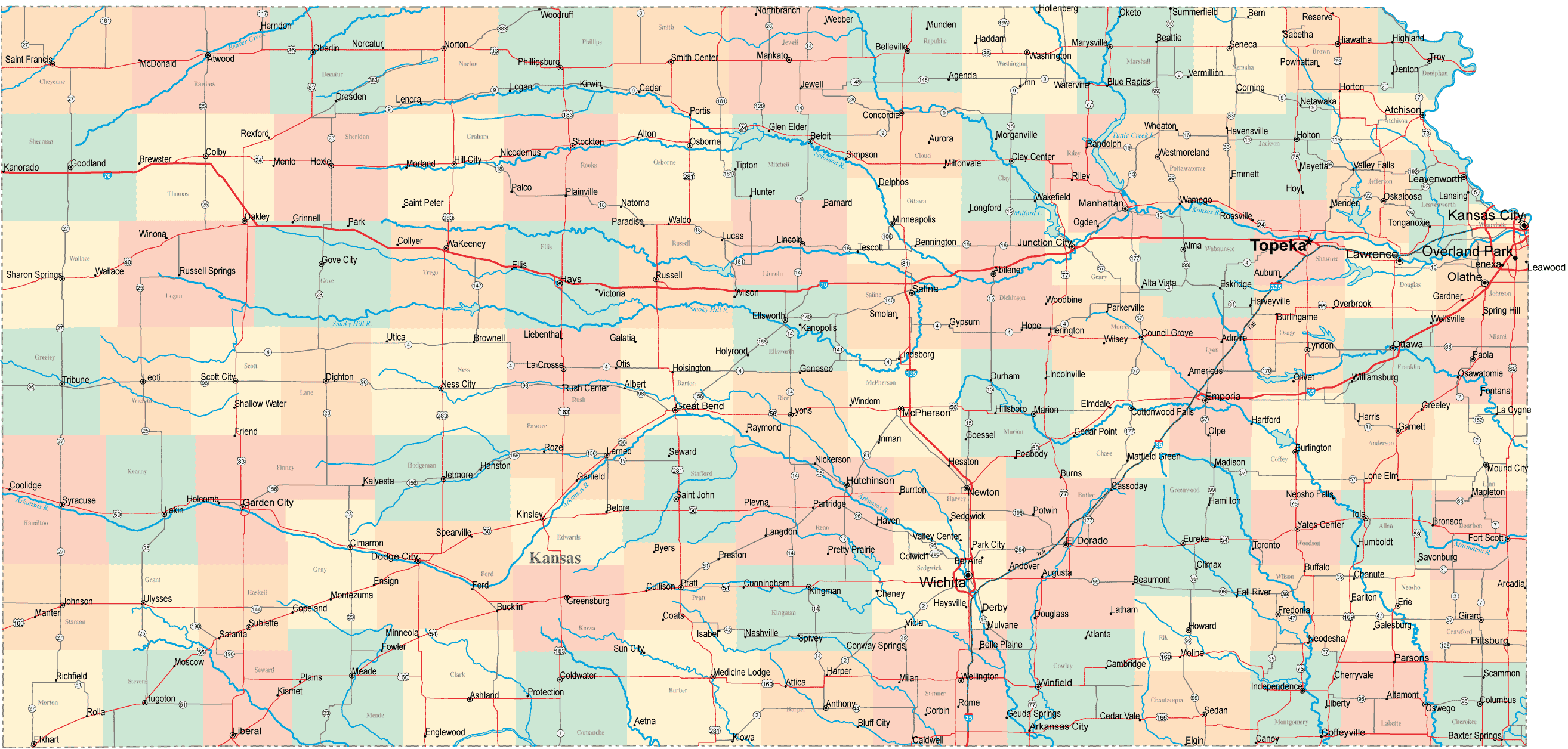
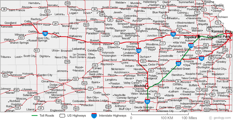
- Kansas Road Map
- Map of Kansas Cities
A Collection of Kansas Maps and Kansas Satellite Images


A collection of Kansas Maps


For all Kansas cities map
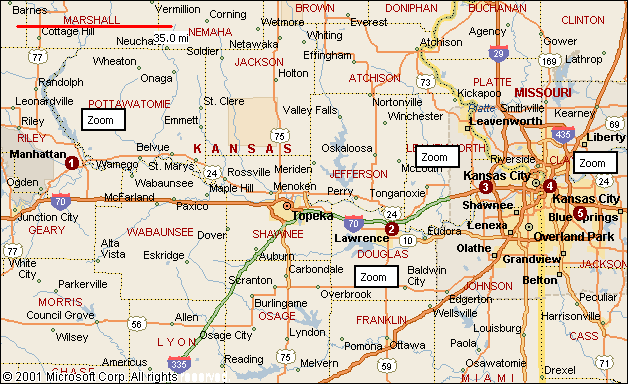
Click for Kansas Direction »
Click for Kansas Street View »
Largest Cities Map of Kansas and Population
Wichita Map - 382,368 Overland Park Map - 173,372 Kansas City Map - 145,786 Topeka Map - 127,473 Olathe Map - 125,872 Lawrence Map - 87,643 Shawnee Map - 62,209 Manhattan Map - 52,281 Lenexa Map - 48,190 Salina Map - 47,707 Hutchinson Map - 42,080 Leavenworth Map - 35,251 Leawood Map - 31,867 Dodge City Map - 27,340 Garden City Map - 26,658Copyright Turkey Travel Guide - 2006 - 2023. All rights reserved. Privacy Policy | Disclaimer