Georgia USA Map
N avigate Georgia USA Map, Georgia USA states map, satellite images of the Georgia USA, Georgia USA largest cities maps, political map of Georgia USA, driving directions and traffic maps.
An Immersive Dive into Atlanta's Essence
Please subscribe on "World Guide" channnel on Youtube at youtube.com/c/WorldGuide
Free Printable High Detailed United States Map with States
Georgia USA Map & Georgia USA Satellite Images

Georgia USA Maps
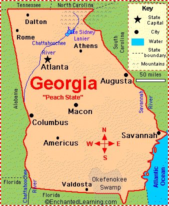
- Map of Georgia USA
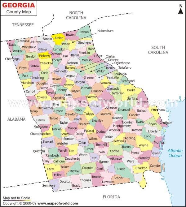
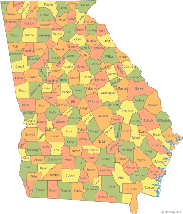
- Counties Map Georgia
- Georgia County Map
- Georgia County Map US
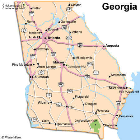
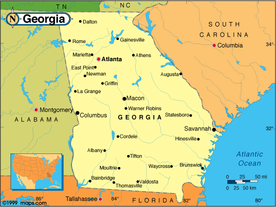
- Georgia Map
- Georgia Road Map
- Georgia State Map
- Georgia County Map USA
- Georgia Map United States
- Georgia Physical Map
- Georgia Political Map
- Georgia River Map
- Georgia State Map US
- Interstate 95 Georgia Map
- Map of Georgia
- Maps of Georgia
- Road Map of Georgia
- State Map of Georgia
A Collection of Georgia USA Maps and Georgia USA Satellite Images


A collection of Georgia Maps


For all Georgia cities map
Click for Georgia USA Direction »
Click for Georgia USA Street View »
Largest Cities Map of Georgia USA and Population
Atlanta Map - 420,003 Augusta Map - 195,844 Columbus Map - 189,885 Savannah Map - 136,286 Athens Map - 115,452 Sandy Springs Map - 93,853 Macon Map - 91,351 Roswell Map - 88,346 Albany Map - 77,434 Johns Creek Map - 76,728 Warner Robins Map - 66,588 Alpharetta Map - 57,551 Marietta Map - 56,579 Valdosta Map - 54,518 Smyrna Map - 51,271 Dunwoody Map - 46,267 North Atlanta Map - 40,456 Mableton Map - 37,115 Rome Map - 36,303 Martinez Map - 35,795Copyright Turkey Travel Guide - 2006 - 2023. All rights reserved. Privacy Policy | Disclaimer