Arizona Map
N avigate Arizona Map, Arizona states map, satellite images of the Arizona, Arizona largest cities maps, political map of Arizona, driving directions and traffic maps.
Unearthing Arizona's Magic: From Desert Sands to Mountain Peaks
Please subscribe on "World Guide" channnel on Youtube at youtube.com/c/WorldGuide
The Earth, North America and Countries View from Space - Day Time and in the Night
Arizona Map & Arizona Satellite Images
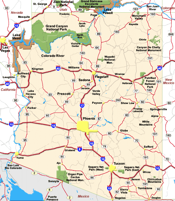
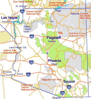
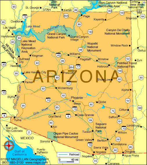
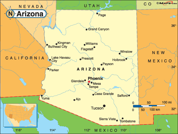
Arizona Maps
- Map of Arizona
- Arizona Cities Map
- Arizona Map
- Arizona State Map
- Arizona Physical Map
- Arizona Political Map
- Arizona Road Map
- Arizona County Map
- Arizona Map USA
- Arizona Map United States
- Arizona Maps
- Political Map of Arizona
- Arizona Recreational Map
- Arizona Route Map
- Arizona Touristic Map
- Cities Map of Arizona
- Map of Arizona US
- Map of Arizona Cities
- Touristic Map of Arizona
A Collection of Arizona Maps and Arizona Satellite Images


A collection of Arizona Maps

For all Arizona cities map
Click for Arizona Direction »
Click for Arizona Street View »
Largest Cities Map of Arizona and Population
Phoenix Map - 1,445,632 Tucson Map - 520,116 Mesa Map - 439,041 Chandler Map - 236,123 Glendale Map - 226,721 Scottsdale Map - 217,385 Gilbert Map - 208,453 Tempe Map - 161,719 Peoria Map - 154,065 Surprise Map - 117,517 Yuma Map - 93,064 San Tan Valley Map - 81,321 Avondale Map - 76,238 Casas Adobes Map - 66,795 Flagstaff Map - 65,870 Goodyear Map - 65,275 Lake Havasu City Map - 52,527 Buckeye Map - 50,876 Catalina Foothills Map - 50,796Copyright Turkey Travel Guide - 2006 - 2023. All rights reserved. Privacy Policy | Disclaimer