Alabama Map
N avigate Alabama Map, Alabama states map, satellite images of the Alabama, Alabama largest cities maps, political map of Alabama, driving directions and traffic maps.
Embarking on a Southern Odyssey: The Enchanting Alabama Experience
Please subscribe on "World Guide" channnel on Youtube at youtube.com/c/WorldGuide
Alabama Map & Alabama Satellite Images
Alabama Maps
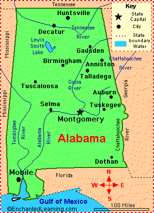
- Map of Alabama
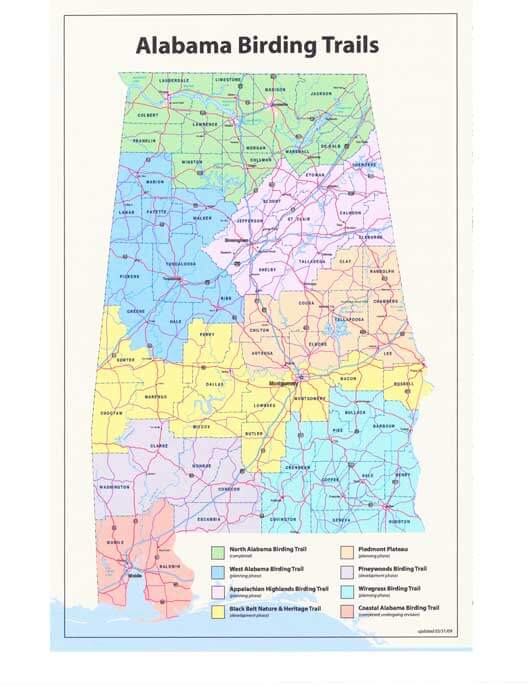
- Alabama Birding Trails Map
- Alabama Cities Map
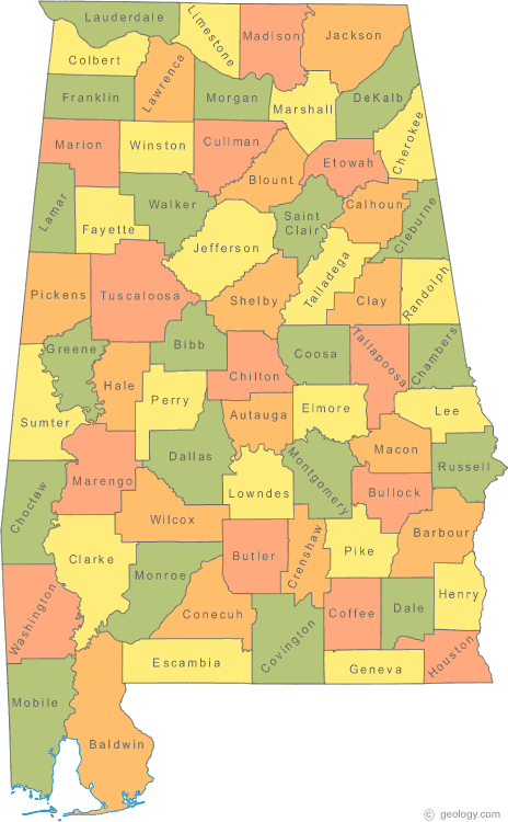
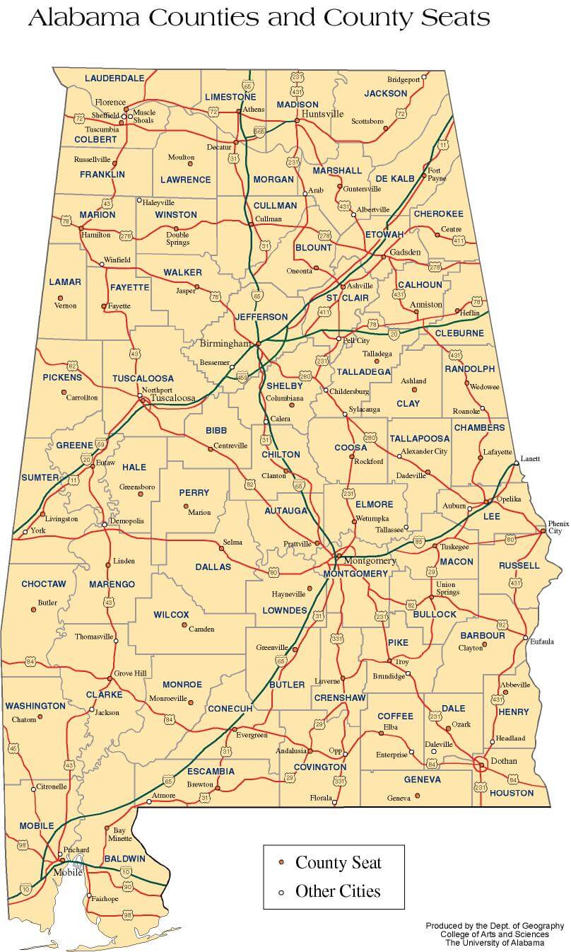
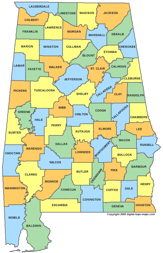
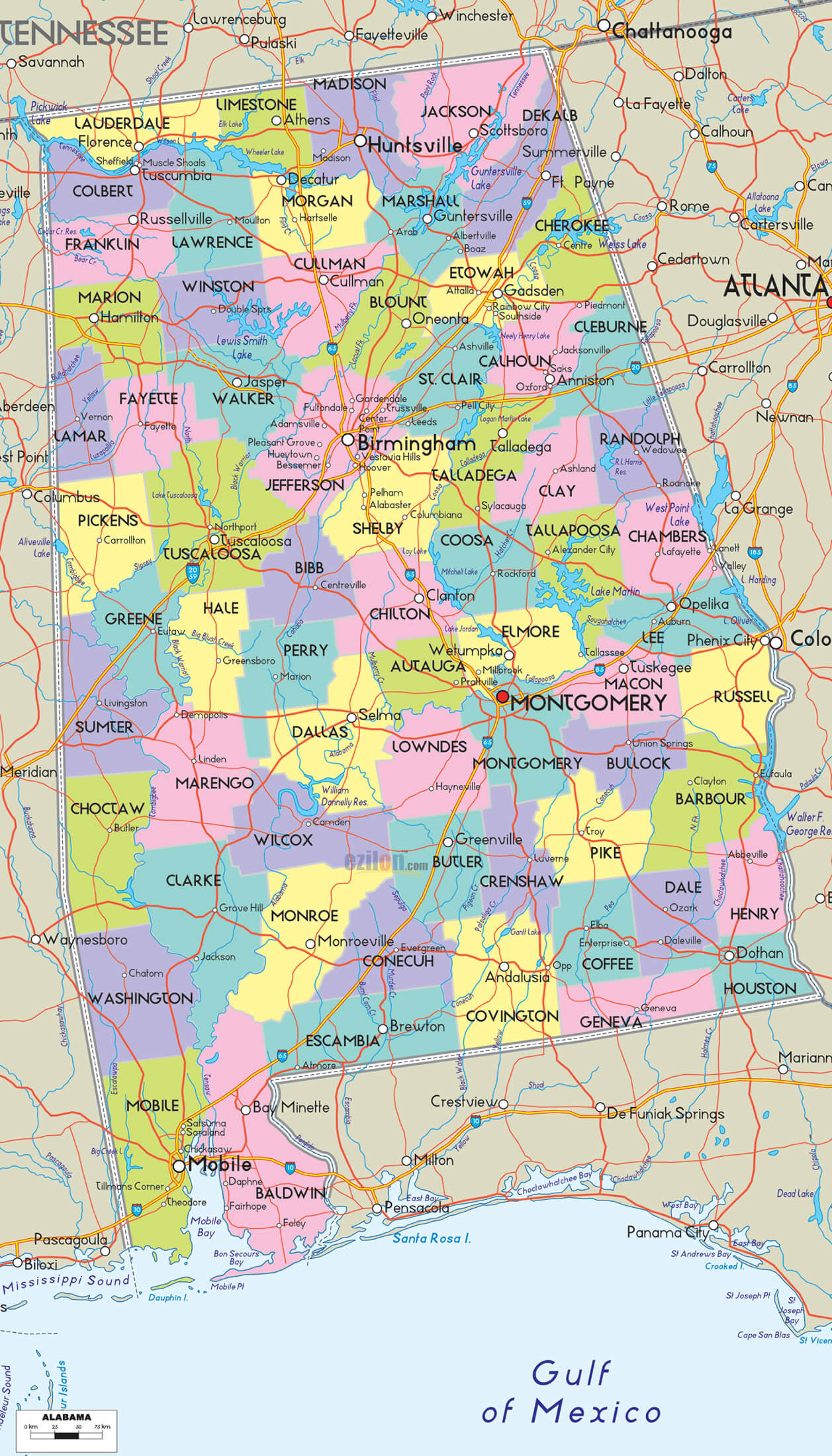
- Alabama Counties Map
- Alabama Historical Map
- Alabama Main Cities Map
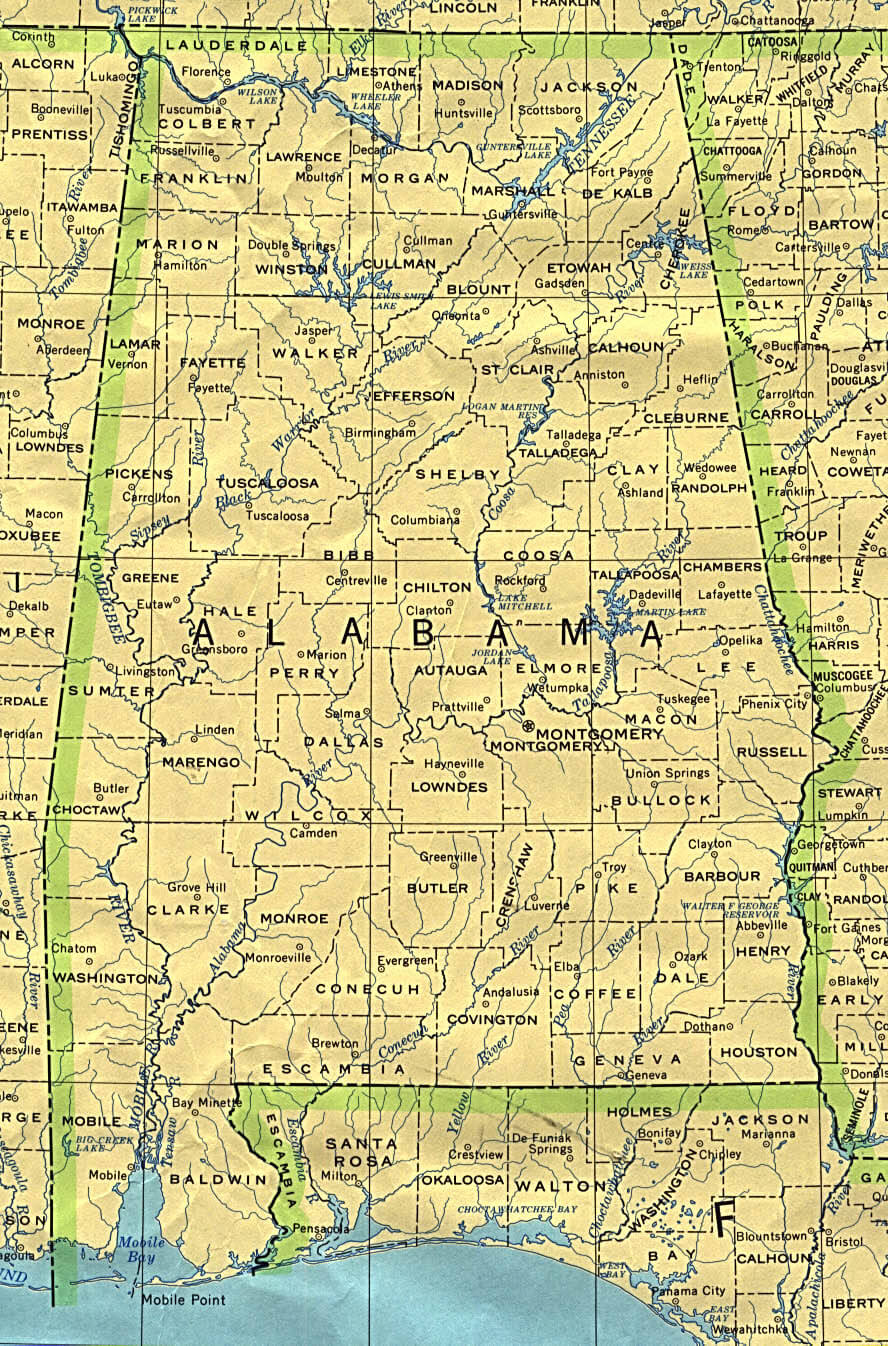
- Alabama Physical Map
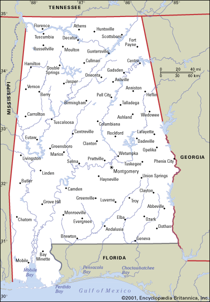
- Alabama Political Map
- Alabama Population Map
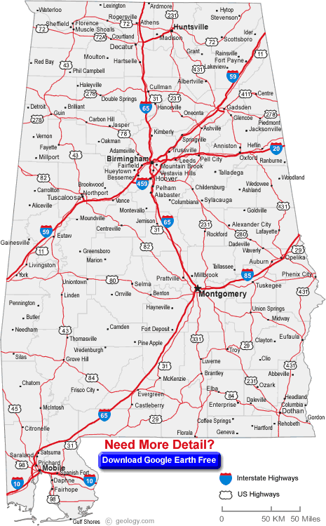
- Alabama Road Map
- Alabama Soil Map
- Alabama State Map
- Alabama USA Map
- Cities Map of Alabama
- Counties Map of Alabama Map
- County Map of Alabama
- Largest Cities Map of Alabama
- Political Map of Alabama
- Rail Map of Alabama
- Road Map of Alabama
A Collection of Alabama Maps and Alabama Satellite Images


A collection of Alabama Maps

For all Alabama cities map
Click for Alabama Direction »
Click for Alabama Street View »
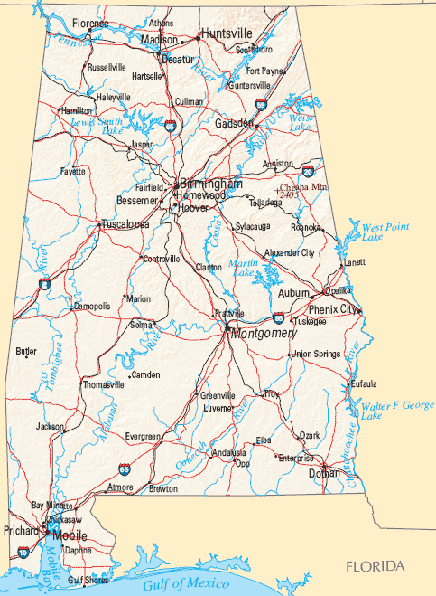
Largest Cities Map of Alabama and Population
Birmingham Map - 212,237 Montgomery Map - 205,764 Mobile Map - 195,111 Huntsville Map - 180,105 Tuscaloosa Map - 90,468 Hoover Map - 81,619 Dothan Map - 65,496 Decatur Map - 55,683 Auburn Map - 53,380 Madison Map - 42,938 Florence Map - 39,319 Gadsden Map - 36,856 Vestavia Hills Map - 34,033 Prattville Map - 33,960 Phenix City Map - 32,822 Blountsville Map - 1,684Copyright Turkey Travel Guide - 2006 - 2023. All rights reserved. Privacy Policy | Disclaimer