Saudi Arabia Map
Navigate Saudi Arabia map, satellite images of the Saudi Arabia, states, largest cities, political map, capitals and physical maps.

- Capital : Riyadh
- Population : 26,534,504
- GDP : $666.805 billion
- Per Capita : $22,663
- Calling Code : +966
- Jobless Rate : 10.50%
- Time Zone : +3
A Collection of Saudi Arabia Maps
Relief Map of Saudi Arabia
 Relief Map of Saudi Arabia - 3D-Rendering.
Saudi Arabia Middle East Map
 Saudi Arabia Middle East Map of the World.
Saudi Arabia Political Map with Provinces
 Saudi Arabia - Highly detailed editable political map with provinces.
Saudi Arabia Territories Map
 Saudi Arabia map with selectable territories. Vector illustration
Saudi Arabia Earth Map
 Highly detailed planet Earth. Night with glowing city lights gives way to day. The boundary of the night & day. Saudi Arabia. Elements of this image furnished by NASA.
Saudi Arabia Map
 Saudi Arabia Map with main cities.
Saudi Arabia Satellite Map
 Highly detailed Earth, illuminated by moonlight. The glow of cities sheds light on the detailed exaggerated terrain. Night Earth. Saudi Arabia.
Saudi Arabia Satellite Map in Night
 Saudi Arabia Satellite Map in Night Highly detailed Earth, illuminated by moonlight.
Saudi Arabia Political Map
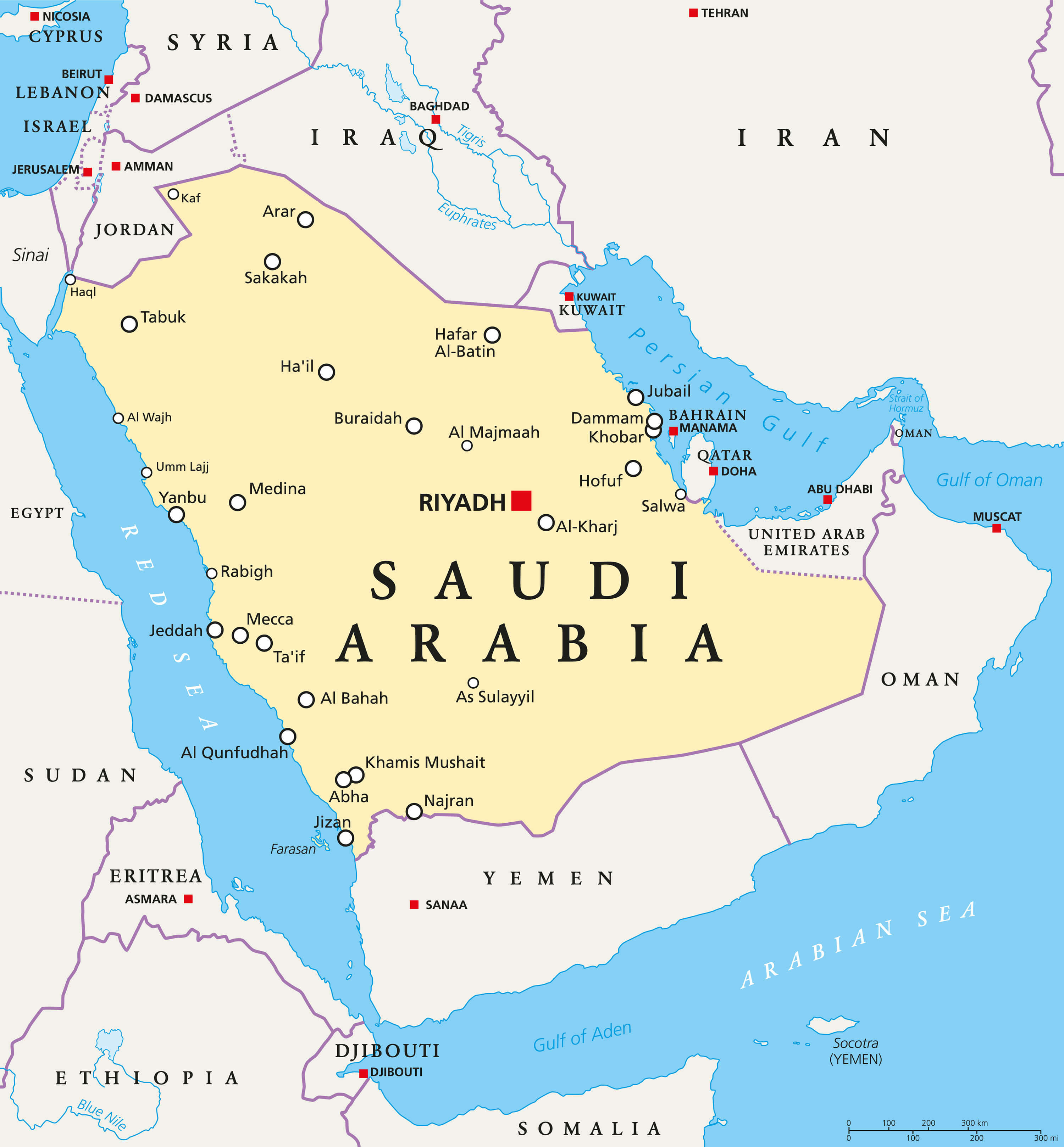 Saudi Arabia political map with capital Riyadh, national borders and important cities. English labeling and scaling.
Saudi Arabia Administrative Map
 Saudi Administrative Map with major cities.
Saudi Arabia Map Middle East
 Middle East. 3D Rendering. Stars my own photo. Elements of this image furnished by NASA.
Largest Cities Map of Saudi Arabia
Abha Map - Dammam Map - Al Hawiyah Map - Al Jubayl Map - Al Kharj Map - Al Khubar Map - Medina Map - Al Mubarraz Map - Al Qurayyah Map - Arar Map - Riyadh Map - Ath Thuqbah Map - At Taif Map - Buraydah Map - Hafar al Batin Map - Jidda Map - Khamis Mushayt Map - Mecca Map - Aba as Suud Map - Sakakah Map - Tabuk Map - Yanbu al Bahr Map -Saudi Arabia Google Map, Street Views, Maps Directions, Satellite Images
Please Not : You can find local businesses, public places, tourist attractions via map view, satellite image, hybrid view, driving directions in Saudi Arabia Map. You'll also find a varity map of Saudi Arabia such as political, administrative, transportation, demographics maps following Google map.
Submit URL to Saudi Arabia :
turkey-visit.com offers a collection of Saudi Arabia map, google map, Asia map, political, physical, satellite view, country infos, cities map and more map of Saudi Arabia.
Please feel free share your comments and questions :
Please feel free share your comments and questions :
"Saudi Arabia" related content to share on social media;


Copyright Turkey Travel Guide - 2006 - 2023. All rights reserved. Privacy Policy | Disclaimer