- world map
- europe map
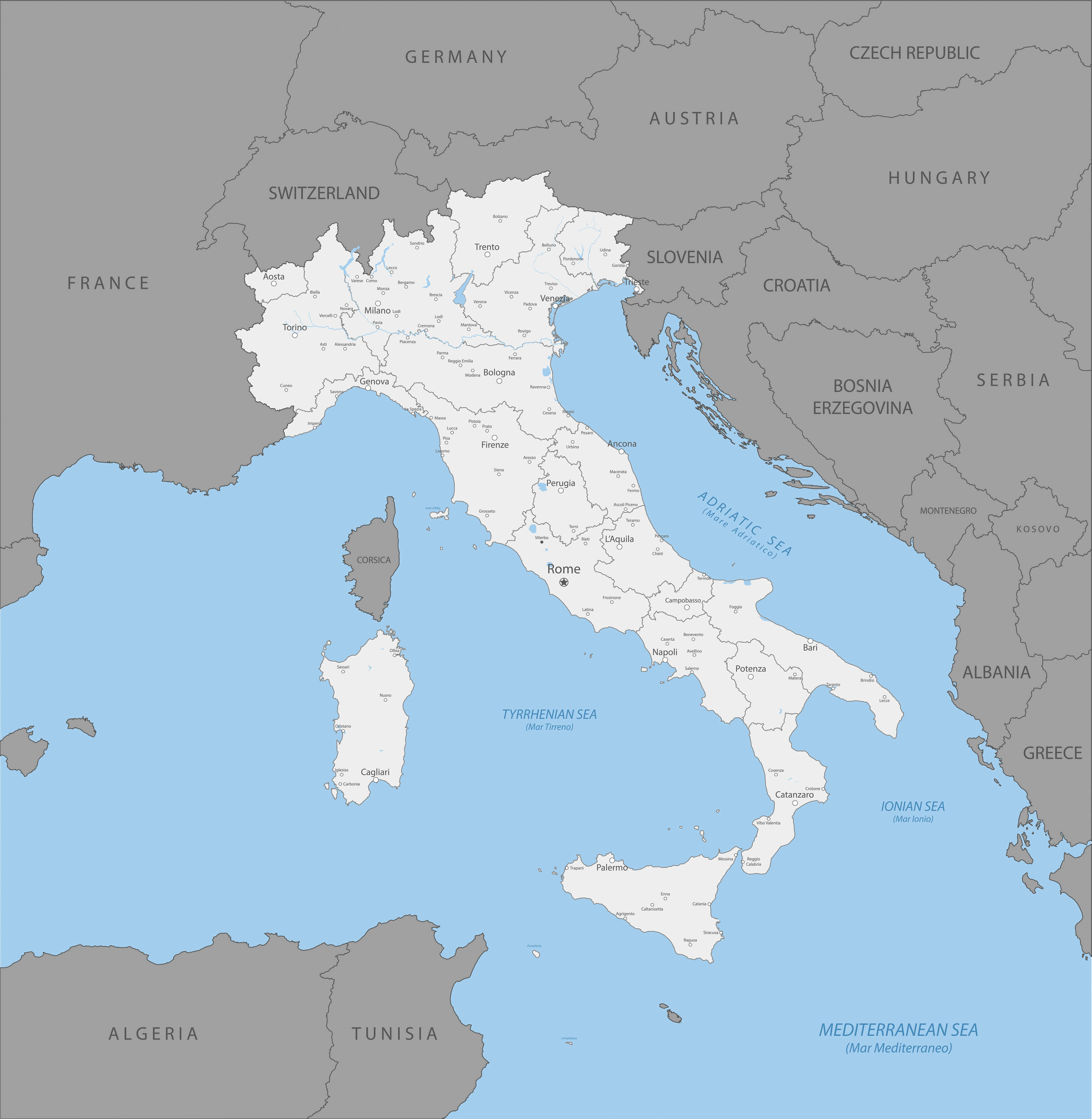
- italy map
Map Italy
Navigate Italy map, satellite images of the Italy, states, largest cities, political map, capitals and physical maps.

- Capital : Rome
- Population : 60,813,326
- GDP : $1.980 trillion (8th)
- Per Capita : $32,522 (24th)
- Calling Code : +39
- Jobless Rate : 11.20%
- Time Zone : +1
A Collection of Italy Maps
Italy Satellite Map

Map of Italy, the time of Emperor Augustus

Map of Italy

Map of Italy, drawn with ink on paper.

Italy map with vector icons
Political map of Italy

Italy Map with Major Cities.

Country Map of Italy
Italy Map Rivers Cities Borders

Map of Italy Vector Illustration.

Italy Administrative Map

Italy Regions Map

Colorful Italy Map Main Cities

Italy Provinces Map

Largest Cities Map of Italy
Rome Map - 2,872,021 Milan Map - 1,337,155 Milano Map - 1,337,155 Naples Map - 978,399 Palermo Map - 678,492 Genoa Map - 592,507 Bologna Map - 386,181 Florence Map - 381,037 Bari Map - 327,361 Catania Map - 315,601 Cesena Map - Como Map - Ferrara Map - Brescia Map - Brindisi Map - Cagliari Map - Bergamo Map - Ancona Map - Foggia Map - Forli Map - Modena Map - Monza Map - Imola Map - Latina Map - Livorno Map - Messina Map - Parma Map - Perugia Map - Pesaro Map - Pescara Map - Piacenza Map - Pisa Map - Prato Map - Ravenna Map - Novara Map - Padua Map - Salerno Map - Sassari Map - Siracusa Map - Taranto Map - Terni Map - Napoli Map - Roma Map - Treviso Map - Trieste Map - Udine Map - Venice Map - Verona Map - Vicenza Map -Italy Google Map, Street Views, Maps Directions, Satellite Images
Please Not : You can find local businesses, public places, tourist attractions via map view, satellite image, hybrid view, driving directions in Italy Map. You'll also find a varity map of Italy such as political, administrative, transportation, demographics maps following Google map.
Submit URL to Italy :
turkey-visit.com offers a collection of Italy map, google map, Europe map, political, physical, satellite view, country infos, cities map and more map of Italy.
Please feel free share your comments and questions :
Please feel free share your comments and questions :
"Italy" related content to share on social media;


Copyright Turkey Travel Guide - 2006 - 2023. All rights reserved. Privacy Policy | Disclaimer